Category Archives: places

farmers with too much time on their hands

Problem: The rice paddy in your backyard vegetable garden is just plain blah. You need to spice it up.

Solution:

Unlike the grass art I posted last Friday, which was made with varying the amount of light given to the grass, this pattern is made with planting different kinds of rice to make the pattern. The technique may be more conventional, but the result is still pretty cool…

Image spotted on the Gamil Design blog [ source ]

a june garden wedding–mine!

I had no idea planning a wedding required making so many decisions. Like, do you go down to the County Building and do the paperwork and ceremony before going to the watch repair shop? And how do you fit grocery shopping into the wedding day?

After 25 years together John and I finally tied the knot a couple weeks ago. I think we went into the whole wedding process thinking that it’d be pretty routine and anticlimactic. Because of that we opted to go downtown and have the county staff do the officiating, all without telling people we knew. (After a quarter century together can you still call it eloping?)

We went through the steps leading up to the ceremony, filling out the paperwork, enduring the unavoidable waiting, making the mound of decisions (Did we want an indoor or outdoor ceremony? Did we want to exchange rings? Did we want a video? Photos? Did we want to purchase a “Just Married” bumpersticker?). And as we were doing that, the seriousness and power of the what was about to happen started to hit us. We started to get nervous.

In line before us were two casually dressed women and their son who disappeared into a conference room for their ceremony. We’d opted for an outdoor wedding, and were soon escorted downstairs and out onto the county building’s sunny south lawn. Two men in tuxedos were finishing up their vows, and in a few minutes it would be our turn. After 25 years of making do, after 25 years of not being able to think that getting married was even an option, it would finally be happening.

The wedding location

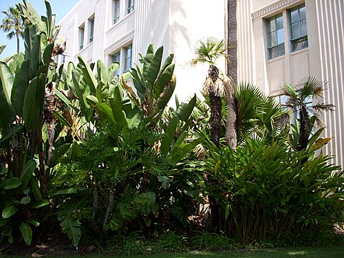
The woman who would be officiating came over and introduced herself, and then we were introduced to our designated witness. We walked over to a sheltered spot that was shaded by leafy palm trees and backed by a lushly subtropical green backdrop of cannas, giant birds of paradise and large-leaved philodendrons that were taller than my head.

The rhythms of a marriage ceremony are usually predictable. The ceremony begins. The official sets the stage with words about how this is both a joyous and serious occasion, and then the official asks the couple about their commitment to each other. As we began to repeat the official’s words, were were saying words that we never thought we’d ever be permitted to utter except in parody. It all seemed at least a little unreal.

As in most other weddings, after the “I do’s,” all the good lines pass back to the official. The official comments on the situation and then intones the ones that signal that the ceremony is about to conclude: “by the powers granted me…” So there in the public garden, we were pronounced married. “You may now seal your vows with a kiss.” Spouse A and Spouse B.

People often badmouth government for what it doesn’t do, while at the same time they take for granted the many things it does and does well, competently, with compassion, grace, and utmost respect. That morning was one of those unsung, unremarked occurrences.

Looking across the south lawn

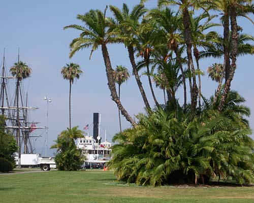
So, you might be wondering, what does an inexpensive walk-in wedding ceremony buy you in the county? For one, if you opt for having it done outdoors, you get a waterfront location, just across the street from the bay and the ships that make up the Maritime Museum. You get a nice garden setting with lush tropical plantings. You get a competent person who will conduct a brief but respectful ceremony. And you might even get as we did, a witness who, when handed your camera, turns out to be an accomplished and seriously underpaid wedding photographer. If you require an official minister or someone dressed as Elvis or Spock to officiate you’ll be out of luck. But we did just fine.

out of darkness something blooms

I had a few CDs cross my desk that were recorded by a San Diego new music collective called Trummerflora. Their name sounded interesting, but I didn’t think another thing about it. Then in the booklet of one of the discs I read its definition:

Trummerflora, or rubble plants and trees, are a special phenomenon unique to heavily bombed urban areas. The bomb acts as a plow, mixing rubble fragments with the earth, which often contain seeds dormant for a century or more. These seeds come to light and those that can live in this new and special earth grow and flourish.
–Helen and Newton Harrison

So something beautiful comes to light through acts of unspeakable destruction. Suddenly I though that it was an amazing word and a concept that holds out some hope that something good can come out of the worst of situations. Of course, this is a particularly tainted kind of goodness, a sort of goodness that you accept because the alternative is so much worse.

Trawling around the web as I write this I couldn’t find other references to this word other than in the context of the musicians or the quote from the Harrisons. Did the Harrisons coin the word? (Of course, just becuase search engines don’t turn up something, it doesn’t mean it doesn’t exist! (Or in this increasingly virtual word, maybe that’s exatly what it means?)) Or did the word spring to life–maybe in Germany?–after the devastation of World War II?


Helen and Newton Harrison. Breathing Space for the Sava River, Yugoslavia, 1988 (detail). Photocollage, text, maps. [ source ]

This whole notion of bringing life back to wastelands has been one of the major themes of Helen Mayer Harrison and Newton Harrison, the artists responsible for the quote in the first place. As a couple they taught at the University of California, San Diego from 1969-1993, and during this time I had the chance to see several of their exhibitions around town. Here’s a description of their working method in Barbara Matilsky’s 1992 book, Fragile ecologies: Contemporary artist’s interpretations and solutions, quoted on a Green Museum page.

After firsthand study, research and interviews with ecologists, biologists and planners the artists create a photographic narrative that identifies the problem, questions the system of beliefs that allow the condition to develop and proposes initiatives to counter environmental damage. They exhibit their documentation in a public forum–a museum, library, city hall–to stimulate discussion, debate, and media attention. By communication to the public the problems that confront a fragile ecosystem and the ways in which the balance can be restored, they exert pressure on the political system and rally public opinion in an attempt to avert ecological disaster.

So, while the Newtons would be pleased to see trommerflora grow and thrive, their greater satisfaction wouldn’t be achieved until we come to an understanding of the systems that brought about the original destruction. And if the projects became so successful that they’d annihilate the need for its the artwork’s own existence? I doubt the Newtons would mind, but I won’t be holding my breath that we get there anytime soon.

Read further: The Newtons in their own words.

virtual vacations: then

In talking about visiting places virtually it’s easy to get caught up in our totally cool advanced state of technology and forget that this sort of visit-by-proxy has been going on for ages.

Homer’s Odyssey gave listeners accounts–albeit mythical–of distant worlds and peoples. In The Persian Wars Herodotus gave readers a more accurate travelogue of places they would very likely never encounter on their own.

The visual arts have always played a strong informational function in this way. Topographically-motivated paintings–works done with varying degrees of verisimilitude–go back to the early days of representation, and gained a high level of polish by the time of the Dutch landscapists such as Albert Cuyp, Salomon van Ruysdael and Jan van Goyen. Paintings by Canaletto, in addition to being snazzy souvenirs for wealthy travelers on the Grand Tour, gave viewers perspectively accurate renditions of an exotic Italy. And the list goes on…

Canaletto. Venice – Grand Canal
Looking South-West from the Chiesa degli Scalzi to the Fondamenta della Croce, with San Simeone Piccolo.
c. 1738.
Oil on canvas – National Gallery, London, UK.
[ source ]


When photography came along its main-line link to reality and reputation for truthfulness kicked up the perceived value of its artifacts as ways to know the world. When the photographic stereoview took the already hyper-real photograph and rammed it into three dimensions people found it revelatory. Millions of stereoviews flooded the market, and you could take virtual vacations to most of the known world: Egypt, South America, Europe, the American West–all over.

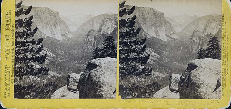
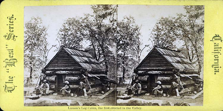
Here are a few of my handful of 1870s eBay stereoviews of places in the west I’m particularly interested in. If you’ve never practiced “free viewing”–basically letting your eyes relax to the point where the left eye focuses on the left image and the right on the right one–give it a try with these. The process might be easier if you click on the image to enlarge it. You know that you’re on the right track when you start to see three images, the left one on the left, the right one on the right, and the stereo composite in between.

(Remember the “Magic Eye” pictures from the 1990s? Those posters of seemingly random piles of pixels where some sort of cheesy 3D image would suddenly come to life when you got your eyes to relax just so? If you could make those pop, you’ve got the idea behind stereo free-viewing down.)

This first is a basic Carleton Watkins view of Yosemite Valley:

Watkins Yosemite Valley stereoview


And this is a shot of Lamon’s cabin, the “first” structure built in Yosemite Valley. (I doubt the Native Americans inhabiting the Valley lived alfresco year round, however…)Lamon's cabin, Yosemite Valley


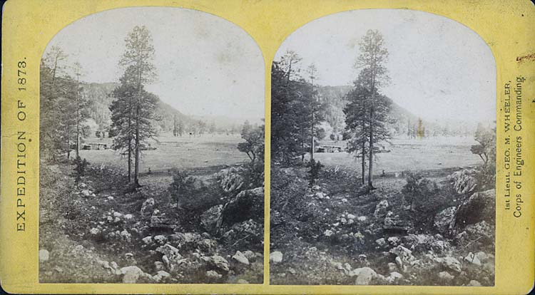
A Southwestern montane forest photographed by Timothy H. O’Sullivan during the 1873 Wheeler expedition, one of the great Western surveys:O'Sullivan meadow stereoview


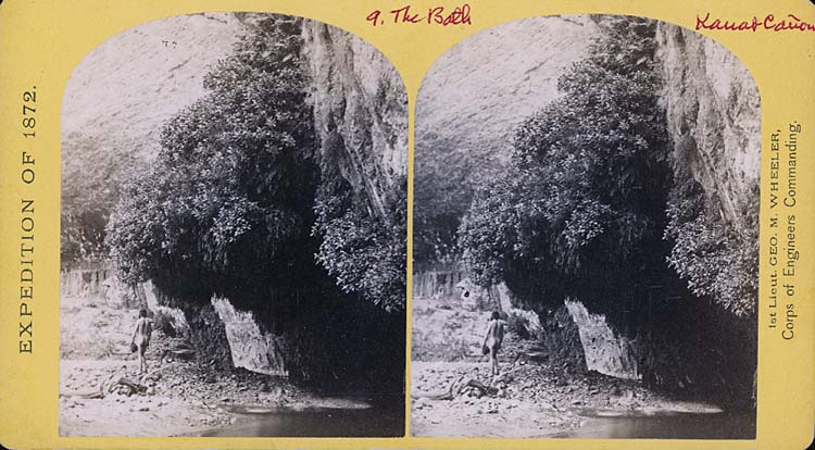
And finally a shot of Kanab Canyon taken by William Bell during the 1872 Wheeler expedition. But wait! What the hell is in this picture? In the finest tradition of using Google Maps to find accidentally recorded images of naked people, could this be? A naked man?Naked guy in Kanab Canyon stereoview


Yeah, tourism and voyeurism, hand in hand, even back then…

virtual vacations: now

Don’t you love it when you talk about two separate things and then something happens that forces an unexpected convergence of the two? Earlier I was doing some Google Street View sightseeing of celebrity gardens. And I’ve posted a few notes (1 2) and photos from my recent Yellowstone trip.

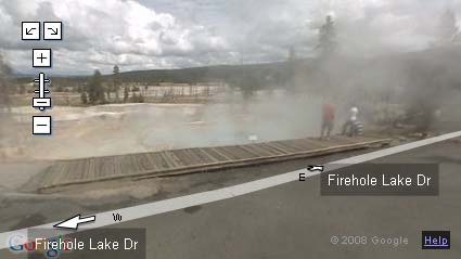
Thanks go to Peter, who the other day pointed out that Google now has added ten parks and recreation areas to Street View, including Yellowstone! So you want to see what the view is along Yellowstone’s Firehole Lake Drive? Just drop into Street View to find out. Of course, like all things virtual, it lacks something of the actual. How will you smell the lodgepole pines or get a whiff of the sulfur fumes rising from the springs?
Google Street View along Firehold Drive Yellowstone

While Street View is a great tool and can let you get a low-res look at places you’d never visit, it’s really just a presentation tool for canned photography. The views are updated periodically, yes, but the periods span many months. What you’re looking at today is soooo yesterday, and in some ways it feels so Web 1.0.

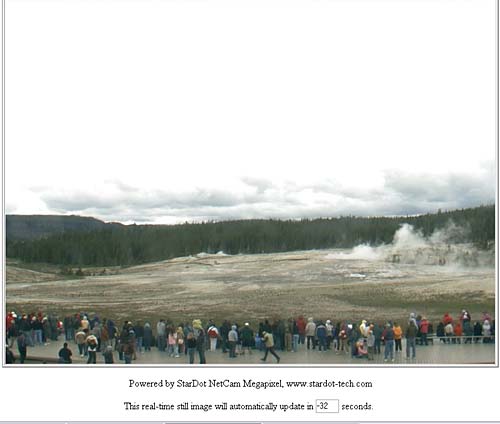
Web cams offer a complement to Street View and can provide an immediacy the former tool lacks. In fact, if you’re interested in the Old Faithful Geyser and Upper Geyser Basin at Yellowstone, there’s a recently installed web cam at the attraction, with images updated at intervals of less than a minute.

Old Faithful webcam

Street View does a nice job of conquering space, giving you the freedom to move around a map and see what there is to see from different locations, and web cams can conquer time by giving you almost-immediate, up-to-date views of things as they’re happening.

What’s the next killer app? What will conquer both space and time?

Will all cars have cameras and GPS installed and then have the images beamed to some central location for real-time descriptions available to anyone on the web so that you can see what things look like right now? And if that happens, who will be the central location serving up the images? Google? The Department of Homeland Security?

niagaras of the east and west

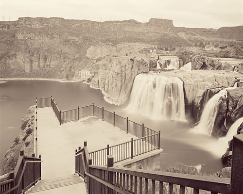
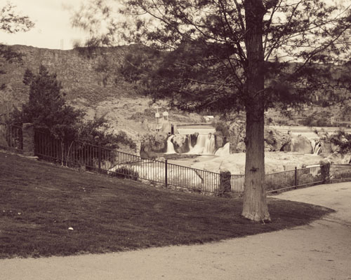
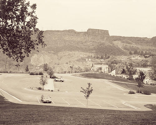
Earlier I posted a couple of my tourist pictures of Idaho’s Shoshone Falls, the “Niagara of the West.” I’ve just begun to scan and print the negatives of the large-format work from the trip. Here are three from the falls:

Viewpoint at Shoshone Falls, Snake River, Idaho:Viewpoint, Shoshone Falls, Idaho

Shoshone Falls Park:Shoshone Falls Park, Snake RIver, Idaho

Parking Lot at Shoshone Falls Park:Parking Lot, Shoshone Falls Park, Idaho

Interestingly, in the pile of newspapers John had saved for me from while I was away, was a book review in the L.A. Times of Ginger Strand’s Inventing Niagara. Interestingly too, in browsing for the book on the web I noticed that it has two different subtitles: “Beauty, Power and Lies,” as well as the more provocative “How Industry, Commerce and Art Conspire to Sell (Out) a Natural Wonder.”

I’d lamented that the Niagara of the West had been despoiled and exploited to an unseemly theme-parkness, and in this long quote in the review Strand has similar things to say about the Niagara of the East:

Manicured, repaired, landscaped and artificailly lit, dangerous overhangs dynamited off and water flow managed to suit the tourist schedule, the Falls are more a monument to man’s meddling than to nature’s strength. In fact, they are a study in self-delusion: we visit them to encounter something real, then observe them through fake Indian tales, audio tours and IMAX films… We hold them up as an example of unconquerable nature even as we applaud the daredevil’s and power-brokers who conquer them. And we congratulate ourselves for preserving nature’s beauty in an ecosystem that, beneath its shimmering emerald surface, reflects our own ugly ability to destroy. On every level, Niagara Falls is a monument to the ways America falsifies its relationship to nature, reshaping its contours, redirecting its force, claiming to submit to its will while imposing our own on it.

Reviewer Tim Rutter, as much as he likes a lot of what Strand has to say, ends up finding the writing of the book to be tiring and frustrating. In that most post-modern technique now turning into cliche, the author’s process of writing the book plays a starring role in the book. When well done it can still be interesting, but in this example Rutter didn’t think that it was. Take that pronouncement under advisement, but it still sounds like the book is a worthwhile read.

yellowstone "wild" flowers

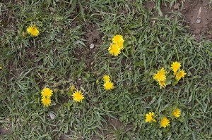
There were a number of spring flowers doing their thing at Yellowstone a couple weeks ago. I saw a patch of bright yellow and took this photo:
escaped dandelions

Yes, dandelions. They were all over. I talked to a ranger nearby who said that the park has a big problem with invasive species. He wasn’t a botanical expert, he said, but he thought there was a true wild dandelion, as well as the garden version. Unfortunately, this to me looks like the garden version. They were all over the park, as well as all over Idaho on the way there.

teed off

In wildness is the preservation of the world.
Thoreau

In a desert, golf is the utter ruin of the known universe.
Me

This is the week of the U.S. Open golf tournament here in San Diego. Something like 42,500 spectator tickets per day have been sold for three days of practice rounds and four of competition. It’s being described as having a string of Super Bowls hitting town, seven days in a row.

To mitigate the potentials for traffic headaches they’re running shuttles for the spectators from Qualcomm Stadium, where they last played the city’s last real Super Bowl, up to the Torrey Pines golf facility, located on the brink of a cliff four hundred feet above the broad sands of Black’s Beach, one of the most spectacular clothing-optional beaches remaining anywhere. And yes, in addition to being a spectacular location for a nude beach it’s also a stunning place to plant a golf course.

Torrey Pines golf course

The Torrey Pines golf course [ source ]

In addition to the shuttles, they’re asking employers surrounding the golf course to limit how many employees show up at work this week. Beyond that, some of the office buildings that border the golf course effectively have been ordered shut down. Rumor is that they don’t want non-paying working stiffs to get a free look at Tiger or Phil or Adam, and that there are security concerns.

To add to the chaos, add to everything that this is finals week at the University of California, located just across the street from the golf course. Oops.

All that rubs me the wrong way. While it might be appropriate to maintain golf courses in cool, wet places like Scotland, it seems somewhere between bizarre and socially irresponsible to dedicate thousands of acres to the game of golf in the desert that is Southern California.

Water is at the forefront of many a Californian’s thinking. Many of us plant our gardens with drought-tolerant plants to maximize our water usage, and we try to limit the size of our lawns.

The San Diego County desert town of Borrego Springs grew to some size as an agricultural area, then began to attract people who grew the town even further. With those people came golf courses and the kind of water use that goes with them. The numbers aren’t exact, but of the total water intake of the town, something like ten percent goes to households (including landscaping), while twenty percent goes to golf courses. The rest goes to the farmers who are complaining that their aquifer is being drained dry. The proportion of water use between residences and golf courses is similar in other desert areas like Palm Springs. So, in a desert, huge numbers of golf courses don’t make much sense.

In addition to the water issues, golf courses are profligate users of pesticides and herbicides. After all, who wants to play golf on a course with brown spots? The Beyond Pesticides site posted a piece establishing links between golf course chemical use and various cancers, and Golf Digest of all publications ran an article, “How Green is Golf,” in its recent May 2008 issue looking at the issue.

Their conclusion? “New courses in the desert will become rarer,” and “The residue of synthetic chemicals are found in high concentrations as far away as the Arctic,” and this quote from a participant at a symposium at Pebble Beach: “From what I know about Augusta National, it’s really a television studio and not a golf course.”

There are signs of encouragement. The weekend San Diego Union-Tribune had an article on how master-planned golf communities are on the wane here in town. Much of the reasoning is economic. There were days when you could build a course here for a million dollars a hole, but rising land values have made that impossible. Seems that the majority of the people who bought into a golf community valued the perceived open space, but only a minority of them ever played the game. It’s proven to be cheaper to set down some hiking trails and preserve the natural open space. In addition, with what is known now about the health hazards of living on a golf course, who’d want to pay extra for the privilege?

So this week I get to endure the U.S. Open along with much of San Diego. While I’m doing that, I keep flashing to this picture in my mind of a driving range that I saw on the outskirts of Borrego Springs, probably the most socially responsible golf facility that I’ve seen anywhere. (Next time I’m out there I’ll try to snap a photo of it.) What tells you it’s a driving range isn’t the sickly fake-green color of its grass. In fact, nobody waters it, and the range is the color of the surrounding desert.

Instead, what tips its hand as a driving range are the golf balls scattered over the facility: thousands of the little white things, glistening in the vibrating mirage-inducing midday atmosphere like bright desert rocks arrayed over the pale brown sands. Now that’s my vision of paradise!

on the road–part 2

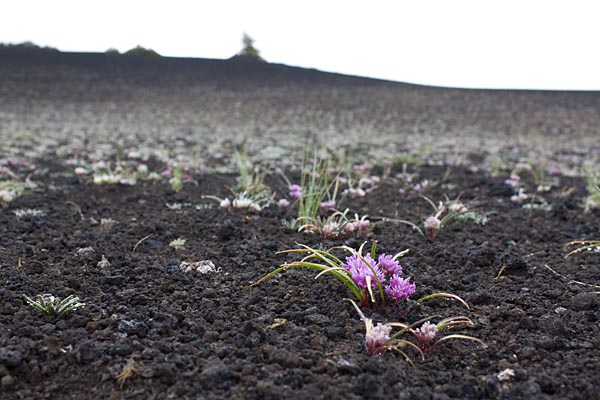
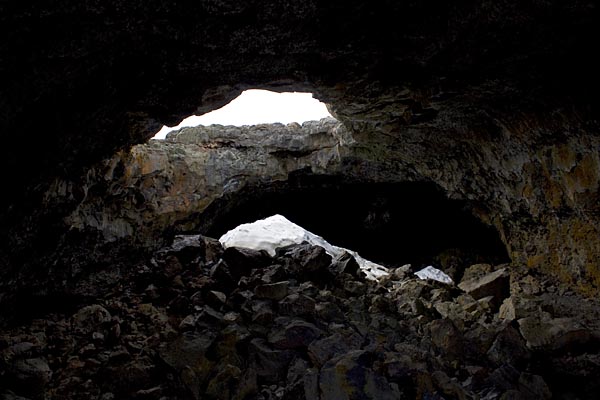
Late on the night of Day 2 I roll into Idaho’s Craters of the Moon National Monument. Like Yellowstone it showcases some striking volcanic feature, in this case recent eruptions along the local rift zone in the Earth’s crust. Here are a couple shots from Day 3, images of an intense wildflower bloom and of residual ice in Indian Tunnel, a lava tube you can explore.
Blooms at Valley of the Moon N.M.

Snow in Indian Tunnel, Valley of the Moon N.M.

Then it was on to Yellowstone. Here are some of the pics from there, in no real order.

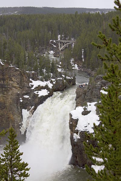
Upper Falls of the Yellowstone River:Upper Fall, Yellowstone River

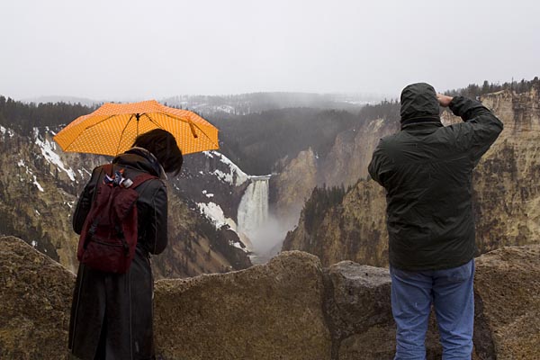
Tourists at Artist’s Point overlooking the Lower Falls of the Yellowstone River. The artist in question is Thomas Moran, who used this vantage point for his famous image of the Grand Canyon of the Yellowstone River.
Tourists at the Lower Falls of the Yellowston River

Tourists at the Lower Falls, Yellowstone River

Spring thaw beginning on Yellowstone Lake:
Spring thaw, Yellowstone Lake

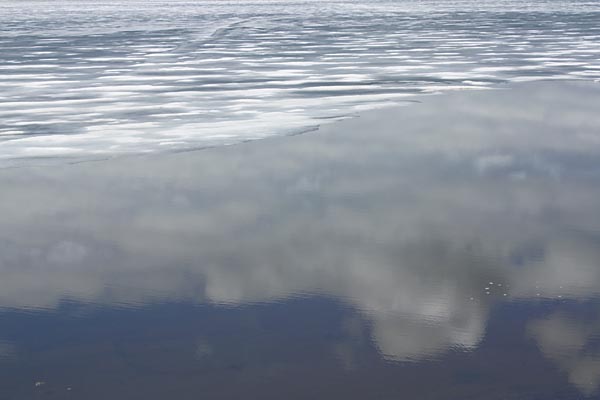
Clouds and ice, Yellowstone Lake:
Clouds and ice, Yellowstone Lake

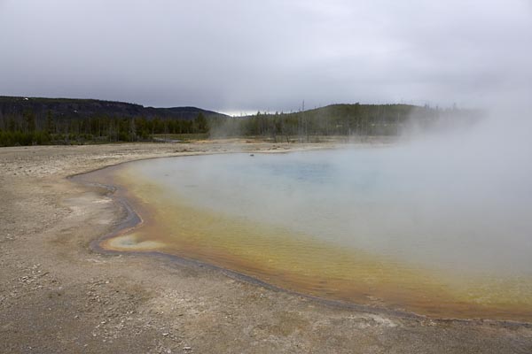
Sunset Lake, Black Sand Basin, Yellowstone:
Sunset Lake, Black Sand Basin

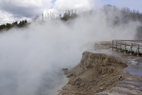
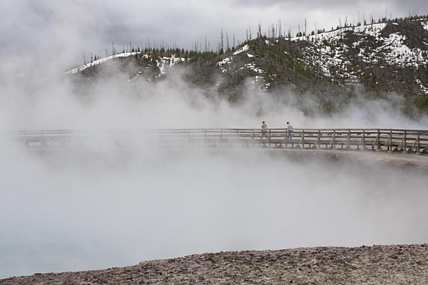
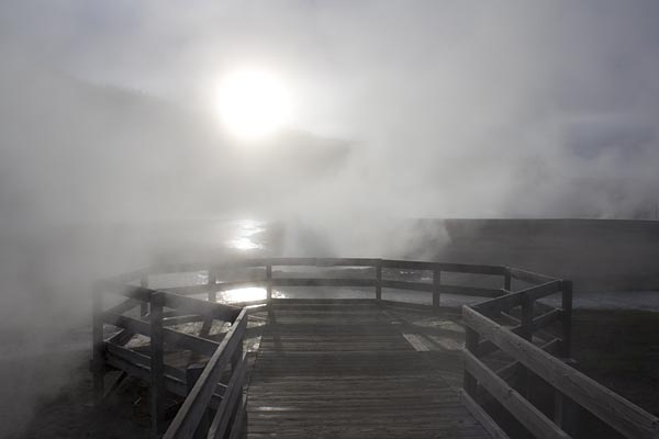
A couple shots from Midway Geyser Basin, from the brink or Excelsior Geyser:Midway Geyer Basin, Yellowstone

Midway Geyser Basin

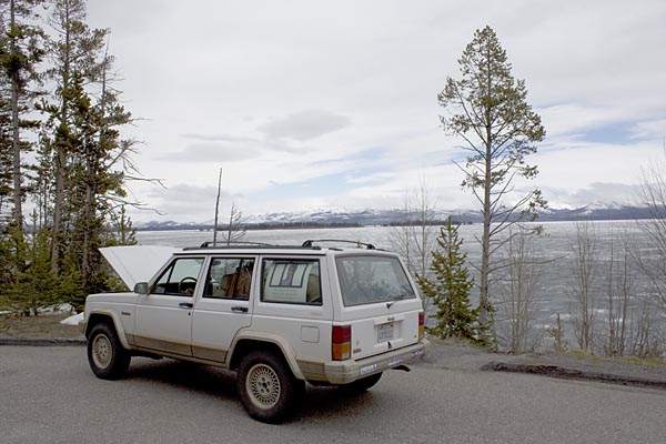
The Jeep didn’t care for the cold, wet weather, and took its own vacation by the side of Yellowstone Lake.
Broken down next to Lake Yellowstone

Viewpoint at Ledge Geyser, Black Sand Basin, Yellowstone, with some of the only sunshine all trip:
Ledge Geyser overlook, Black Sand Basin, Yellowstone

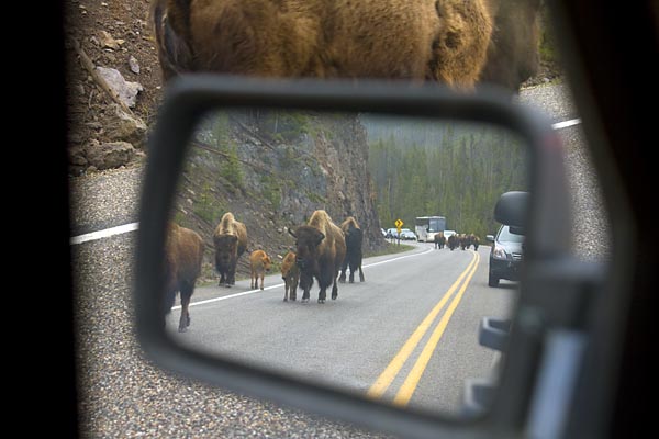
The worst of the trip’s bison jams, this one when a herd of about five dozen was moving from their breakfast to lunch grazing locations:
Bison jam, Yellowstone

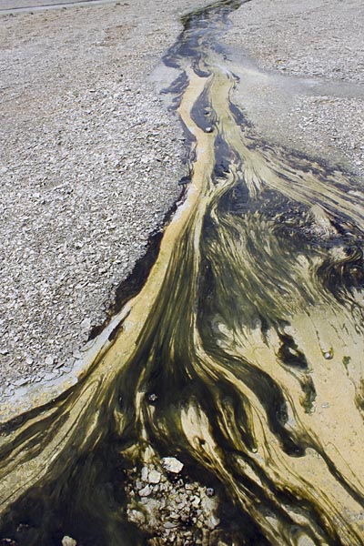
Algae in the geyser runoff at Norris Geyser Basin:
Algae at Norris Geyser Basin, Yellowstone

What? No pictures of Old Faithful? Sorry. There’s a couple hundred more of these tourist pictures but I’ll spare you. Once I start printing up some of my more “serious” photographic work and have something to show I’ll post a few more images.

the danger of houseplants

Confession time. I have this fixation on Antarctica.

Most people who go to spas and do time in hotels with pool bars don’t understand it. But, as with all other perfectly honorable fetishes, it’s surprising and reassuring the number of people I run into who actually get it.

Sometime in the mid 1990s I was seriously planning a trip there, though it’s a trip that I still haven’t taken. I was trawling around what was then the internet, doing some random research, when I came across some memos from the National Science Foundation concerning houseplants in Antarctica that at the time I found a little bizarre:

In line with requirements of the Antarctic Conservation Act
[Section 4. Prohibited Acts (a) (C)], and its regulations
[Subpart B, Section 670.4 (f)], the Senior U.S. Representative,
Antarctica issued a directive reminding U.S. Antarctic Program
participants of prohibitions against maintenance of household
plants at U.S. Antarctic Program (USAP) stations and facilities.
That directive is attached to this Environmental Action
Memorandum.

To further implement the directive, this Environmental Action
Memorandum details approved methods for disposition of any
household plants (and associated materials) that currently may be
at USAP stations or facilities.

Disposition of Household Plants

Any household plants, associated growth media (e.g., soil), and
associated growth containers currently at any USAP station or
facility shall be turned over immediately to the NSF
Representative (or designee). Such plants and growth media shall
be incinerated in a suitable metal waste collection barrel (non-
plastic growth containers shall be incinerated at the same time).
The resultant ash and debris shall be retrograded from Antarctica
following approved procedures. No plastic growth containers
shall be incinerated (these shall be compacted and placed in a
suitable metal waste collection barrel for subsequent retrograde

from Antarctica). Special handling or approvals may be required
for the retrograde of these soil “contaminated” plastic growth
containers.

Sidney Draggan

Back then I thought it was ridiculous that anyone would be worried about creeping charlies, spiderplants, philodendrons and diffenbachias taking over the pack ice. Even today it does seem to lean a bit towards the overprotectionist direction, but not by much. Caution is always good with fragile ecosystems like Antarctica. Even if the main houseplants wouldn’t become weeds and take over the continent, who knows what damaging viruses and other pathogens could be stowaways in potting soil, pathogens that might threaten the few plants that live there today.

Way back when, Antarctica wasn’t positioned at the South Pole, and it was warm enough to host many plants, including forests of Antarctic beech trees. In this day and age of global warming, who knows how long it’d be before penguins would end up having to roost in fields of someone’s escaped African violets?