Tag Archives: Carleton Watkins

some of my favorite photographs

My visit after Christmas to the Getty Center had as its main destination an exhibit of photographs by Carleton Watkins.

Watkins worked all over the West Coast, and was the first person to develop an important body of work on Yosemite. The show contained beautifully preserved examples of his photographs, including a few that rank up there among my all-time favorite photographs ever taken.

Carleton Watkins: El Capitan

Carleton Watkins: El Capitan, 1860s [ Library of Congress ]

More than one person has argued that Watkins is the first important artist to come out of California, regardless of medium, and I would not argue that point. There’s a poise and stillness to the work. The images seem to float in their own time and space that extends to infinity.

Even after an hour in a crowded series of galleries, the work left me with a sense of stillness that I still feel, over a week later. (The fact that I’m still on vacation also probably has something to do with it…)

watkinsfirstviewofyosemitevalley

Carleton Watkins: First View of the Yosemite Valley from the Mariposa Trailca. 1866.

In the image to the left, El Capitan, the light-colored mass of granite to the distance in the left, balances elegantly with the bulk of the nearer hillside on the right. It’s an amazingly formal, modern image. I don’t know of any drawing, painting or other photograph from up to this time that looks anything like it.

(This is one of two versions of this image taken at the same time from the same vantage point. I prefer the other version of this image, which is in the Getty show. I wasn’t able to find anything on the web to borrow of either version, so this quick shot out of one of my books that at least gives you an idea of the image.)

Carleton Watkins: Cape Horn, Columbia River

Carleton Watkins: Cape Horn, Columbia River, 1867 [ National Gallery of Art ]

I had a conversation with Roy Flukinger, Curator of Photography & Film at the Harry Ransom Humanities Research Center at the University of Texas at Austin, about nineteenth century landscape photographs. He spoke of a “transubstantiation” of matter that occurs in many of them, where the long exposures and photographic techniques rendered water, air and land to be almost equivalent materials. In the image above, the water and sky and distant mountains merge into each other. The cliffs to the right seem to float over the water. At the same time, they seem to fit into the rocks to the left like a key fits into a lock, or the way the shape of Africa reaches across the Atlantic to nestle into the empty space of the Caribbean on a map.

Carlton Watkins: Cape Horn near Celilo, 1867

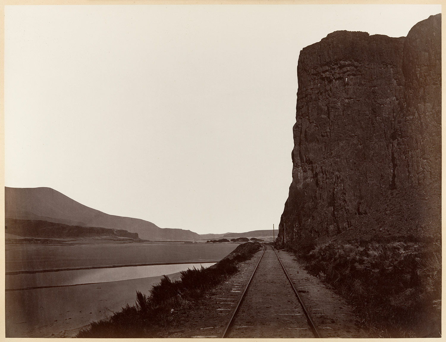
Carleton Watkins: Cape Horn near Celilo, 1867 [ Metropolitan Museum of Art ]

The quietness and sense of infinite space in this one is phenomenal. If your blood pressure doesn’t drop ten points after viewing this image, nothing will bring it down!

Dialogue Among Giants: Carleton Watkins and the Rise of Photography in California runs until March 1.

virtual vacations: then

In talking about visiting places virtually it’s easy to get caught up in our totally cool advanced state of technology and forget that this sort of visit-by-proxy has been going on for ages.

Homer’s Odyssey gave listeners accounts–albeit mythical–of distant worlds and peoples. In The Persian Wars Herodotus gave readers a more accurate travelogue of places they would very likely never encounter on their own.

The visual arts have always played a strong informational function in this way. Topographically-motivated paintings–works done with varying degrees of verisimilitude–go back to the early days of representation, and gained a high level of polish by the time of the Dutch landscapists such as Albert Cuyp, Salomon van Ruysdael and Jan van Goyen. Paintings by Canaletto, in addition to being snazzy souvenirs for wealthy travelers on the Grand Tour, gave viewers perspectively accurate renditions of an exotic Italy. And the list goes on…

Canaletto. Venice – Grand Canal
Looking South-West from the Chiesa degli Scalzi to the Fondamenta della Croce, with San Simeone Piccolo.
c. 1738.
Oil on canvas – National Gallery, London, UK.
[ source ]


When photography came along its main-line link to reality and reputation for truthfulness kicked up the perceived value of its artifacts as ways to know the world. When the photographic stereoview took the already hyper-real photograph and rammed it into three dimensions people found it revelatory. Millions of stereoviews flooded the market, and you could take virtual vacations to most of the known world: Egypt, South America, Europe, the American West–all over.

Here are a few of my handful of 1870s eBay stereoviews of places in the west I’m particularly interested in. If you’ve never practiced “free viewing”–basically letting your eyes relax to the point where the left eye focuses on the left image and the right on the right one–give it a try with these. The process might be easier if you click on the image to enlarge it. You know that you’re on the right track when you start to see three images, the left one on the left, the right one on the right, and the stereo composite in between.

(Remember the “Magic Eye” pictures from the 1990s? Those posters of seemingly random piles of pixels where some sort of cheesy 3D image would suddenly come to life when you got your eyes to relax just so? If you could make those pop, you’ve got the idea behind stereo free-viewing down.)

This first is a basic Carleton Watkins view of Yosemite Valley:

Watkins Yosemite Valley stereoview


And this is a shot of Lamon’s cabin, the “first” structure built in Yosemite Valley. (I doubt the Native Americans inhabiting the Valley lived alfresco year round, however…)Lamon's cabin, Yosemite Valley


A Southwestern montane forest photographed by Timothy H. O’Sullivan during the 1873 Wheeler expedition, one of the great Western surveys:O'Sullivan meadow stereoview


And finally a shot of Kanab Canyon taken by William Bell during the 1872 Wheeler expedition. But wait! What the hell is in this picture? In the finest tradition of using Google Maps to find accidentally recorded images of naked people, could this be? A naked man?Naked guy in Kanab Canyon stereoview


Yeah, tourism and voyeurism, hand in hand, even back then…