
Thanksgiving Day saw us on the road, with some of that time exploring the crest of the Laguna Mountains about 90 minutes to the east of here. The stretch of S1 over the crest has one of those wonderfully poetic names: Sunrise Highway.

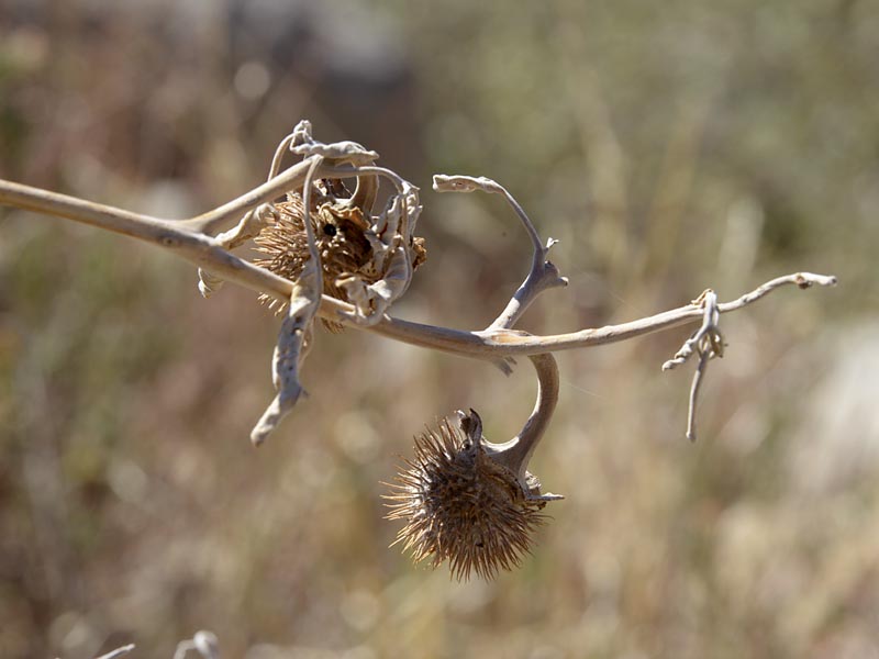
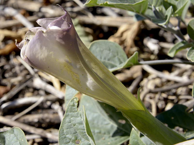
There’s a chance (ever-diminishing as I look at the forecasts) of winter weather on the way, but things were still blooming away here and there… A patch of Corothrogyne (Lessingia) californica, buckwheats, Datura wrightii, with both flowers and seed pods, a living example of optimism and practicality living side by side…


Patches of yellowing leaves let you know it was fall, but it’s a pretty low-color year this time around. (The California Fall Color blog has the same opinion, and blames it on the bark beetle and drought.) Without the magic of Photoshop this dull photo would have been even duller.

Anyone traveling this route must stop at this amazing overlook down Oriflamme Canyon and over Vallecito Valley (which translates redundantly into “Little Valley Valley”). The valley floor lies more than a mile below the viewpoint, but the atmospherics today were amazingly clear. Since my last visit, the Chariot fire had swept through the area, taking out over 7,000 acres of landscape and almost 150 structures, including the Shrine Camp and one of the cabins at the Sierra Club’s historic Foster Lodge. That was back in July of 2013.

Like most California wildfires in this area, this one had a human origin–a BLM Jeep igniting some dry plants beneath it. Natural processes are geared to try to go back to some semblance of where things were before the fire, but the disproportionate number of human-source fires presses hard on the plants. A landscape that can recover from burning every century doesn’t do well when stressed unreasonably. Invasive plants can move in and change the makeup of the vegetation completely.

This area can see some pretty extreme wind speeds, and this spot is not far from the place where wind gusts topped 100 mph this past May during our most extreme Santa Ana Wind condition in recent memory. You might guess that from the shredded flag. Add some embers to winds like that and you have the perfect firestorm.
But…it wasn’t doing that on this bright November day, and for that we were thankful, not to mention being thankful for the great scenery and looks at the great plants that live here.
You can take your own version of this trip courtesy Google Street View. I’ve placed the marker right at the big viewpoint. Enjoy your tour along the Sunrise Highway!
so glad to see you are back to blogging!
I’m your first subscriber on Feedly (which I use now Google Reader is dead)
We moved last week, and were welcomed by a fire on the mountain slopes. Watched helicopters waterbomb the fire.
Our highway to the coast is called Sunset Highway. The scenery is totally different but equally pleasing. Thanks for taking us along on your Thanksgiving drive.
Sunrise…sunset…too funny!
The Google street view is great…thanks. I drove Sunrise Hwy at night under a full moon last January, and it brought back memories of camping with friends at Burnt Rancheria . And going up one November day to see the oaks turning russet at a bend in the road. (Quercus kelloggii?)
Great fall post, even if the drought has less foliage in the mountains turning. I hope your area gets a good soaking soon, and more to come.
The soaking came, and there’s more on the way. Maybe next fall will have a little more color? We can all hope!