Category Archives: landscape

an artist in the garden: Manny Farber

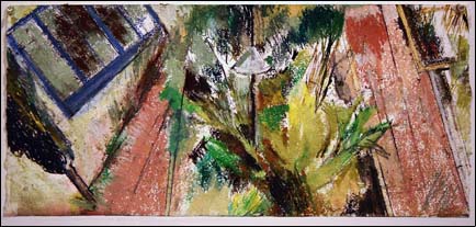
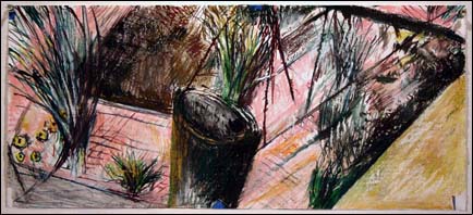
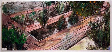
Manny Farber, one of San Diego’s treasured local artists, had a new exhibition at Quint Contemporary Art in La Jolla (actually just a neighborhood of San Diego, but don’t tell that to the La Jollans). The title of the show is “Drawing Across Time,” and features works on paper Farber executed in the garden of the home that he shares with fellow artist Patricia Patterson.

Manny Farber Drawing Across Time image


Manny Farber Drawing Across Time image


Manny Farber Drawing Across Time image
Manny Farber. Drawing Across Time (details). Mixed media on paper, 9 7/8 x 22 3/8 inches.

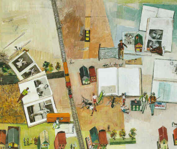
Lively diagonals animate the horizontal-panoramic-format mixed-media works, and space swirls around with the garden viewed simultaneously from different vantage points. His earlier work, such as the one below, share a similar sense of space, but being closer to drawing than painting, the work is freer, looser and more immediate. And of course be sure to add two and a half decades of thoughtful development to the equation.

Manny Farber: Sam's Bunch 1980-81
Manny Farber. Sam’s Bunch, 1980-81. Oil on canvas, 43.7 x 52.2 in.

Unfortunately, the exhibition closed yesterday, on June 14, but the Quint Gallery site has a generous sampling of the work online.

yellowstone "wild" flowers

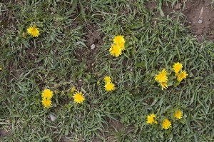
There were a number of spring flowers doing their thing at Yellowstone a couple weeks ago. I saw a patch of bright yellow and took this photo:
escaped dandelions

Yes, dandelions. They were all over. I talked to a ranger nearby who said that the park has a big problem with invasive species. He wasn’t a botanical expert, he said, but he thought there was a true wild dandelion, as well as the garden version. Unfortunately, this to me looks like the garden version. They were all over the park, as well as all over Idaho on the way there.

teed off

In wildness is the preservation of the world.
Thoreau

In a desert, golf is the utter ruin of the known universe.
Me

This is the week of the U.S. Open golf tournament here in San Diego. Something like 42,500 spectator tickets per day have been sold for three days of practice rounds and four of competition. It’s being described as having a string of Super Bowls hitting town, seven days in a row.

To mitigate the potentials for traffic headaches they’re running shuttles for the spectators from Qualcomm Stadium, where they last played the city’s last real Super Bowl, up to the Torrey Pines golf facility, located on the brink of a cliff four hundred feet above the broad sands of Black’s Beach, one of the most spectacular clothing-optional beaches remaining anywhere. And yes, in addition to being a spectacular location for a nude beach it’s also a stunning place to plant a golf course.

Torrey Pines golf course

The Torrey Pines golf course [ source ]

In addition to the shuttles, they’re asking employers surrounding the golf course to limit how many employees show up at work this week. Beyond that, some of the office buildings that border the golf course effectively have been ordered shut down. Rumor is that they don’t want non-paying working stiffs to get a free look at Tiger or Phil or Adam, and that there are security concerns.

To add to the chaos, add to everything that this is finals week at the University of California, located just across the street from the golf course. Oops.

All that rubs me the wrong way. While it might be appropriate to maintain golf courses in cool, wet places like Scotland, it seems somewhere between bizarre and socially irresponsible to dedicate thousands of acres to the game of golf in the desert that is Southern California.

Water is at the forefront of many a Californian’s thinking. Many of us plant our gardens with drought-tolerant plants to maximize our water usage, and we try to limit the size of our lawns.

The San Diego County desert town of Borrego Springs grew to some size as an agricultural area, then began to attract people who grew the town even further. With those people came golf courses and the kind of water use that goes with them. The numbers aren’t exact, but of the total water intake of the town, something like ten percent goes to households (including landscaping), while twenty percent goes to golf courses. The rest goes to the farmers who are complaining that their aquifer is being drained dry. The proportion of water use between residences and golf courses is similar in other desert areas like Palm Springs. So, in a desert, huge numbers of golf courses don’t make much sense.

In addition to the water issues, golf courses are profligate users of pesticides and herbicides. After all, who wants to play golf on a course with brown spots? The Beyond Pesticides site posted a piece establishing links between golf course chemical use and various cancers, and Golf Digest of all publications ran an article, “How Green is Golf,” in its recent May 2008 issue looking at the issue.

Their conclusion? “New courses in the desert will become rarer,” and “The residue of synthetic chemicals are found in high concentrations as far away as the Arctic,” and this quote from a participant at a symposium at Pebble Beach: “From what I know about Augusta National, it’s really a television studio and not a golf course.”

There are signs of encouragement. The weekend San Diego Union-Tribune had an article on how master-planned golf communities are on the wane here in town. Much of the reasoning is economic. There were days when you could build a course here for a million dollars a hole, but rising land values have made that impossible. Seems that the majority of the people who bought into a golf community valued the perceived open space, but only a minority of them ever played the game. It’s proven to be cheaper to set down some hiking trails and preserve the natural open space. In addition, with what is known now about the health hazards of living on a golf course, who’d want to pay extra for the privilege?

So this week I get to endure the U.S. Open along with much of San Diego. While I’m doing that, I keep flashing to this picture in my mind of a driving range that I saw on the outskirts of Borrego Springs, probably the most socially responsible golf facility that I’ve seen anywhere. (Next time I’m out there I’ll try to snap a photo of it.) What tells you it’s a driving range isn’t the sickly fake-green color of its grass. In fact, nobody waters it, and the range is the color of the surrounding desert.

Instead, what tips its hand as a driving range are the golf balls scattered over the facility: thousands of the little white things, glistening in the vibrating mirage-inducing midday atmosphere like bright desert rocks arrayed over the pale brown sands. Now that’s my vision of paradise!
on the road–part 2

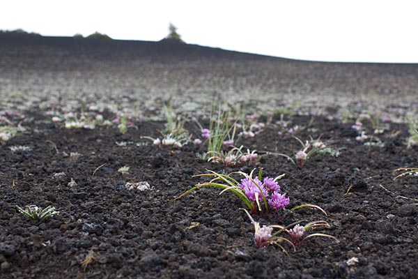
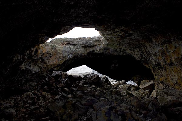
Late on the night of Day 2 I roll into Idaho’s Craters of the Moon National Monument. Like Yellowstone it showcases some striking volcanic feature, in this case recent eruptions along the local rift zone in the Earth’s crust. Here are a couple shots from Day 3, images of an intense wildflower bloom and of residual ice in Indian Tunnel, a lava tube you can explore.
Blooms at Valley of the Moon N.M.

Snow in Indian Tunnel, Valley of the Moon N.M.

Then it was on to Yellowstone. Here are some of the pics from there, in no real order.

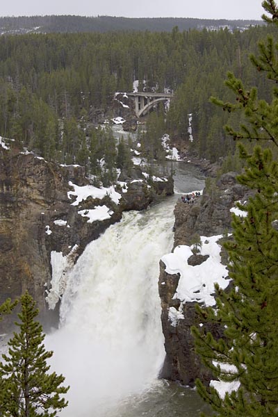
Upper Falls of the Yellowstone River:Upper Fall, Yellowstone River

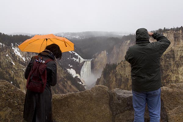
Tourists at Artist’s Point overlooking the Lower Falls of the Yellowstone River. The artist in question is Thomas Moran, who used this vantage point for his famous image of the Grand Canyon of the Yellowstone River.
Tourists at the Lower Falls of the Yellowston River

Tourists at the Lower Falls, Yellowstone River

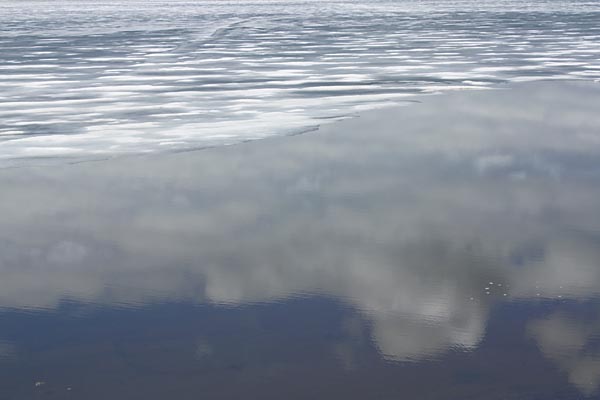
Spring thaw beginning on Yellowstone Lake:
Spring thaw, Yellowstone Lake

Clouds and ice, Yellowstone Lake:
Clouds and ice, Yellowstone Lake

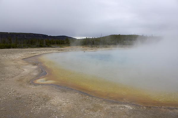
Sunset Lake, Black Sand Basin, Yellowstone:
Sunset Lake, Black Sand Basin

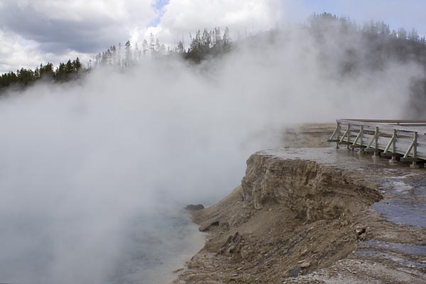
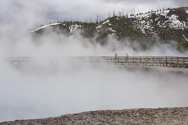
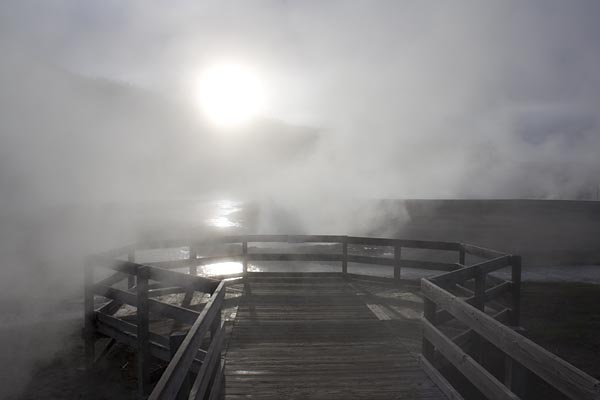
A couple shots from Midway Geyser Basin, from the brink or Excelsior Geyser:Midway Geyer Basin, Yellowstone

Midway Geyser Basin

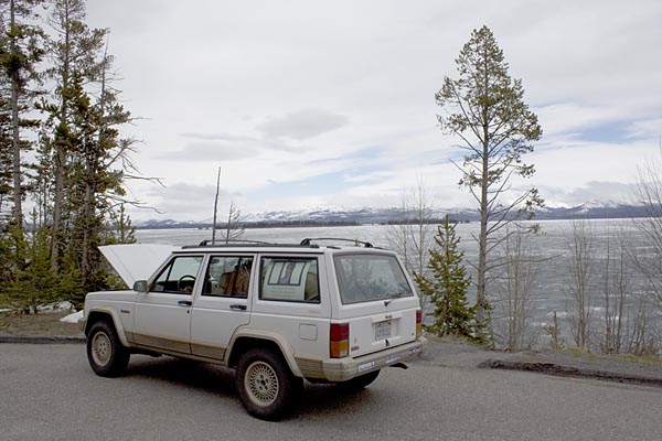
The Jeep didn’t care for the cold, wet weather, and took its own vacation by the side of Yellowstone Lake.
Broken down next to Lake Yellowstone

Viewpoint at Ledge Geyser, Black Sand Basin, Yellowstone, with some of the only sunshine all trip:
Ledge Geyser overlook, Black Sand Basin, Yellowstone

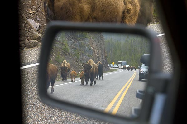
The worst of the trip’s bison jams, this one when a herd of about five dozen was moving from their breakfast to lunch grazing locations:
Bison jam, Yellowstone

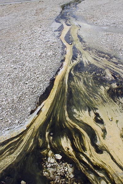
Algae in the geyser runoff at Norris Geyser Basin:
Algae at Norris Geyser Basin, Yellowstone

What? No pictures of Old Faithful? Sorry. There’s a couple hundred more of these tourist pictures but I’ll spare you. Once I start printing up some of my more “serious” photographic work and have something to show I’ll post a few more images.

wild and out of control

All over town here in San Diego you see the black mustard plant, Brassica nigra, now approaching the end of its blooming period.

The undulating yellow mounds of it doing its thing are a spectacular sight, so much so that Napa Valley, up north in the wine country, has an annual Mustard Festival that’s just come to its conclusion. The festival host the expected Napa wine and food offerings, and also hosts contests in photography, art and cooking with mustard. In addition to how the plant looks, it has an interesting history, as told by Napa pioneer Calvin Chesterfield Griffith, quoted on the Mustard Festival’s site:

This is the story of our early California when it was only a wilderness, with great quantities of trees, beautiful plains, all kinds of wild animals and birds; many, many Indians, and no white men at all.

Father Serra had come from Spain to Mexico to spread the religion of Jesus Christ, and hearing about this beautiful, vast country to the north, decided to explore it. With a few faithful followers and Indian guides, he traveled north through what is now our glorious and loved California. As he traveled he scattered to the right, and to the left, the mustard seeds which he had brought with him from Spain.

The following year, as they returned south they followed ‘a ribbon of gold;’ and following that path again Father Serra established his ‘Rosary of Missions,’ beginning in San Diego and ending in Sonoma.

It’s an appealing, romantic story, but it also sidesteps the fact that the mustard has invaded much of the West, and can be found in most of the United States. As a robust winter annual, it can out-compete most native plants, particularly in disturbed locations, and form virtual monocultures that prevent other plants from getting a foothold. The pictures above were taken a few blocks from my house, in Tecolote Canyon. Because of abundant moisture earlier in the year, the plants were well over my head in spots, easily seven feet tall.

To the left is a picture of a part of the canyon where the mustard hasn’t taken over. It’s a good example of coastal sage scrub, rich in plantlife and alive with birds and insects. The white-flowering plant in the foreground is black sage, Salvia mellifera, blooming up a storm, with yellow deerweed (Lotus scoparius) behind it. So what would I prefer–a rich ecological mix of plants that host a range of animal life, or a showy burst of color that nourishes almost no animal life and is about to dry out to a wildfire magnet?

Alert on a new invasive: Cousin Jenny, a new Master Gardener in South Carolina, alerted me to a new invasive plant, cogongrass, a plant that’s being listed as a treat even worse than the suffocating kudzu. Here’s a link to a story in the Beaufort Gazzette. Like the black mustard, it’s an attractive plant, but it’s also serious bad news.

More on weeds and invasives: I’ve been leafing through Weeds of California and Other Western States, by Joseph M. DiTomaso and Evelyn A. Healy. It’s a sumptuous two-volume set, a coffee-table book of weeds if there ever was one, with 3000 images of the 750 evil species it lists. It also comes with a CD-ROM of the images in the book that can be used without royalties for educational purposes.

In addition to the 750 nasties, there’s a table in the back with potential future threats from plants that are just entering the ecosystem. The book leans towards the technical side, but there’s a handy glossary and index. It took me 20 minutes to figure out that the annoying grass coming up in spots around the yard was tall veldgrass. But with other species I was able to go right to the offender.

I found it striking that a huge number of the weeds–like the black mustard–were of European origin, likely brought over by settlers from there over the past centuries. Controls have since been erected that help reduce the entry into the country of plants that might prove invasive. However, with people, products and produce jetting all around the world these days, it’s inevitable that there will be waves of invading plants from regions other than Europe. The cogongrass that’s of concern in the South, for instance, comes from Asia.

As I wander around the yard inventorying the plants coming up in the crevices, it’s weirdly comforting to know that my yard is contributing to preserving the earth’s biological diversity–though unfortunately I’m not necessarily helping along the species that really need it the most!

a fake forest

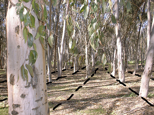
fakeforest.jpg
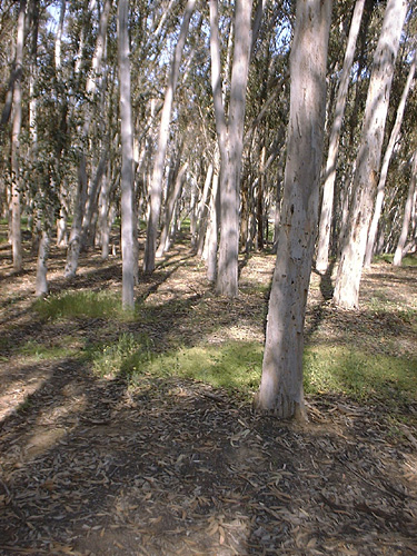
Last time, I wrote about going to the eucalyptus groves at UCSD to look for wildflowers. I’ve always been fascinated with these areas of the campus. Boston ivy growing on brick buildings might define the look of certain East Coast schools, but here it’s the eucalyptus trees.

At first your eye follows the trunks on these trees, in the summer covered with beautiful exfoliating bark, up to the high branches and out to the weeping branches that come back towards earth, often with vivid red coloration on the stems, contrasting with the slender gray-green leaves. Individually the trees are striking, and growing together they give the impression of a light, sunny forest. Pay some attention to how they’re planted, however, and the initial impression of pristine nature falls apart. Below I’ve taken a picture and drawn black lines that accentuate the rigid rows that were used to plant the “forest.” Not so natural after all. Southern California, home of the simulacra manufactured in Hollywood, the fake features of Disneyland, and the artificially buxom women of West-Side L.A., does it again.

fakeforest2.jpg

You probably know that the trees are native to Australia, and may know that down under they’re sometimes called “widow-makers” because of their tendency to drop their branches onto people. You may even know their history in Southern California, that they were planted by the millions as part of various get-rich schemes in the later 19th and earlier 20th centuries, with promises that they’d grow wood for railroad trestles or ocean piers, or that they’d yield essential oils with all sorts of miraculous properties. A great article in the Journal of San Diego History goes into some of their fascinating past.

The plantings that remain throughout Southern California are beautiful stands. The occasional grove even harbors monarch butterflies on the migrations. (An area of the UCSD groves used to be alive with monarchs during the winter in the earlier 1980s, but I haven’t seen more than the occasional monarch since then. Too bad, for sure.) But these groves of perfectly-aligned trees for me talk about culture and nature, and of the ways accidents of history shape how the world looks today.

into the wild

A couple posts ago I mentioned dichelostemma blooming in the garden and I was thinking that they were probably also blooming wild in the natural spaces around me. I took a lunchtime walk through one of the semi-wild areas on the north part of the campus of the University of California, San Diego. The area has been set aside as a natural preserve, although “natural” in this case is actually a canyon of native plants mixed in with some earlier 20th century plantings of eucalyptus. Fake as it may be as a genuine Southern California chaparral ecosystem, the edges where the grove meets the scrub starts to take on more native flavors.

There had been heavy rains this past January, followed by occasional wet periods, so the ground was still moist in spots. The weather was now turning warm, sunny and spring-like. Grasses were growing exuberantly. It wasn’t long before I started to notice occasional flowers in the understory. Although the spaces under the eucalyptus prove hostile to most flowering plants other than the occasional also-imported black mustard, the blue dicks were pretty content to be there, a single plant here, big rafts of them there.

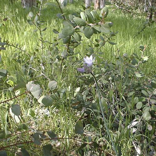
bluedickswild2.jpg
A flowering head of Dichelostemma capitatum, mixed in with the grasses and eucalyptus

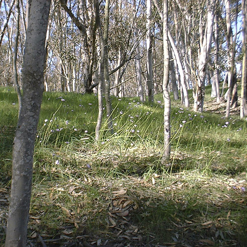
bluedickswild.jpg
A larger stand of them, with their little flower heads raised up two feet or more in the dappled shade

I was tuned in to what I was seeing, but in the back of my mind I was aware that back in my garden the same species of plants was also blooming. Back home the blue dicks are part of a long continuum of “springtime” flowers that begin with the first narcissus in October and continue into a number of plants that have yet to bloom. But in the wild areas of Southern California this is it. Spring is short and–in a wet year like this one–intense, orgiastic. As the weather warms the rains will stop. The grasses will die out and the flowers will fade out. Soon the long brown season will begin. But in the fictionalized natural world of my garden, spring will be here for several more months. I’ll enjoy it for sure. But somehow it seems a little wrong.

convergences

Here’s an image I ran across in the LA Times this morning that I wanted to share:
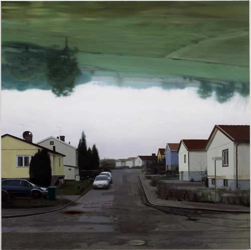
tommyhilving.jpg


It’s a painting entitled “The Bridge” by Swedish painter Tommy Hilding in his current Urban View show at the Angles Gallery in Santa Monica. I haven’t seen it live in person, but the reviewer talks about how the image is constructed from “screen-printed dots, puddles of photo emulsion” with “smeared squeegee marks over the images.” In that way, the work references photographs, and more specifically photographs in reproduction.

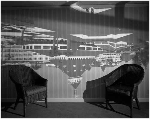
In the way the rural landscape hangs over the banal homes, streets and gardens, however, it also strongly references the camera obscura and photography using camera obscura-like inverted images. The photographer most known for doing this currently is Abelardo Morell. He basically takes a room somewhere, draws all the shades, pokes an aperture into the shade, and lets the inverted image of what’s outside shine inside, turning the room into a camera obscura. He then photographs the dim image cast on the wall with a view camera using a long exposure, sometimes several hours. Here’s one of his camera obscura images that he made, this one here in San Diego County at the Hotel del Coronado:

abemorrell.jpg


Abelardo Morell: Camera Obscura Image of Hotel Coronado in Room, San Diego, CA, 1998

For me, Morrell’s camera obscura images are visually striking but ultimately unresolved. Yes, they play with the ideas of indoor/outdoor, public/private, but ultimately I don’t find the images to be particularly nourishing. (There are other examples of his work, though, that I really do like quite a bit.) Other photographers are now copying Morell’s technique, but what I’ve seen hasn’t gone into any territory not already explored by Morell.

Another photographer who’s mined somewhat related territory where a right-side-up image is fused with an upside-down one is Harry Callahan in some of his multiple-image experiments. These are shots where the featureless sky prints out white from the relatively intense amount of exposure the sky areas get in relation to the rest of the image. Since the sky prints white, and since he’s inverting the camera between exposures, the tops and bottoms of these images are white. The only thing that isn’t white is a band of information in the middle of the picture that consists of a small piece of a building with another superimposed on top of it, upside-down. I don’t think Callahan had anything in mind other than doing some formal studies, and these images succeed brilliantly in doing just that. He sets a goal, then creates some stunning images that exemplify his intentions. Morell’s images are graphically interesting, but it’s the intention part that I’m not sure I get. So his camera obscura series doesn’t gel for me in the same way Callahan’s works do.

Anyway, Back to Tommy Hilding. In using this camera obscura-like trick of right-side-up and upside-down, he’s made an interesting image graphically. But there’s a richness to his image beyond the formal qualities. Is the green inverted landscape the more pristine land that was bulldozed and chopped up to create the blight below? It’s probably not as literal as that, but the question hangs in the air as much as the landscape hangs over the little suburban homes and barren patches of garden space. In Beauty in Photography : Essays in Defense of Traditional Values, the photographer Robert Adams quotes Albert Camus, who wrote that the the builders of the City of Oran had managed to “exorcise the landscape.” Is this what’s happened here? Is the original landscape hanging over all of our heads in our squalid little cities like some indictment? Is it the ghost of something that’s lost to us forever? Or is it hanging over us like some dark premonition, ready to drop and crush us?

gardens, phonebooths, poetics and old maids

I’ve been rereading The Poetics of Gardens, a wonderful, witty, thoughtful book by architect Charles Moore, landscape architect William Turnbull and theorist William J. Mitchell. In two places it references Igor Stravinsky’s Poetics of Music, in which Stravinsky argues that sounds can’t be considered to be music until a human mind has organized them. (John Cage, of course, would argue you blue if you said that to him…) Extending Stravinsky’s argument, Moore and friends argue that a space can’t be considered to be a proper garden until it’s been shaped by human actions.

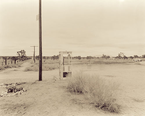
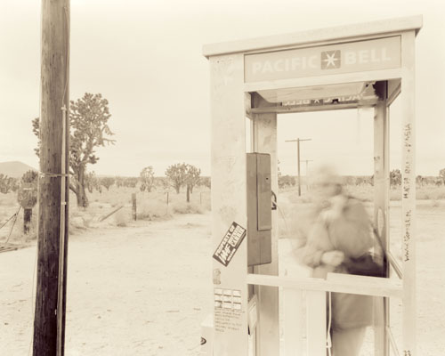
The situation at the Mojave Phonebooth brings their argument to mind. The Mojave National Preserve purports to set aside a piece of nature for the enjoyment of the general population in a way that mirrors the mission of the Yosemites and Yellowstones of the world. One of the main reasons that we go to these places is to commune with the wonders and pleasures of the world beyond our garden walls and city gates. We go to commune with nature.

But the very names many of these places gives away the real situation, with many of them called “national parks” or “state parks” or “regional parks.” And parks–think of New York’s Central Park–raise expectations of spaces under human control. The removal of the phonebooth was just an obvious symptom of this control, a control that goes througout the natural system, from the construction of roads and visitor facilities to restricting what kinds of activities a person can do in a certain place. Humans are now positioned so that they could exert obvious control anywhere on earth. The Amazon’s getting slashed and burned and there’s comfy year-round housing on the South Pole. And what’ not under control now could be with varying amounts of effort. I’m in some ways a gullible Romantic and I work hard to guard that precious naiveté, but–as much as I hate to admit it–this “nature” thing is now an artificial distinction.

I won’t try to answer the “when did nature end” question, but something’s that interested me is looking at the controls that ended it. It’s been said in various places that one of the methods of controlling something is to name it–Just think of how many mountains bear the names of people that have had political power and abilities to control people and landscapes. A distinct form of naming features is where features in the landscape are given bear names based on their supposed human characteristics.

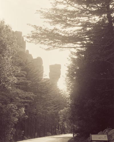
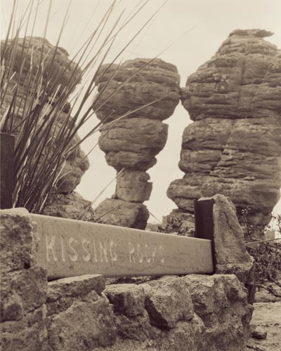
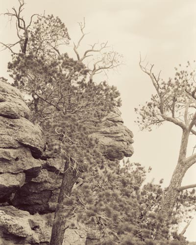
Over the years I’ve been noticing places that have names like “Indian Head” or “Kissing Rocks.” The place that made me really stand up and take notice (and stimulate my gag reflex) was Chiricahua National Monument, in extreme southeastern Arizona, when I first visited it in the early 90s. Here, a 1930s trail goes through an area known as the “Heart of Rocks,” where there’s a concentration of features 10-30 feet tall bearing plaques labeling them in all sorts of distinctly human terms, using names drawn from a hodgepodge of cultural referents. This is where I saw Kissing Rocks, two just-touching formations with lip-like protrusions. Then there’s “Punch and Judy Rock,” and “Totem Pole,” and “Thor’s Hammer.” Mixed in with these, “Big Balanced Rock,” “Camel,” and “Mushroom Rock” seemed much more benign.

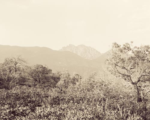
I returned to Chiricahua last Spring and decided that it would be and interesting project to document some of these formations. On the way up the mountain I was explaining what I was doing to a Park Service ranger. Of all the formations, one of the ones that she’d had the most negative reactions to was “Old Maid.” And, down the mountain a ways, be sure to check out “China Boy,” she suggested. Then there’s a whole mountaintop easily viewable from the parking lot at the top of the mountain that’s labeled “Cochise Head,” a questionable homage to Cochise, who held up for several years in these mountains before he was captured.

If you look at the Park Service literature for the park you’ll see “Big Balanced Rock” mentioned, but they’ve downplayed the other names. The plaques remain, however, maybe as a reliquaries to the1930s mindset that came up with most of the names. (The ranger I spoke to thought that Cochise Head might date further back, to the late 1800s.)

So why all these names? Sure, someone was having some fun with it all, but I’m interested in the questions bubbling below the surface. Are humans so scared of or alienated by “nature” that they have to project human traits on it to be able to begin to deal with it? Are we so blind to natural processes and geology that we can only understand it on our terms? Is naming something the beginning of a long chain of controlling actions that ultimately leads to its destruction?


chiricahua-china-boy.jpg
James SOE NYUN: “China Boy,” Chiricahua National Monument, Arizona, 2007
chiricahua-cochise-head.jpg
James SOE NYUN: “Cochise Head,” Chiricahua National Monument, Arizona, 2007
chiricahua-kissing-rocks.jpg
James SOE NYUN: “Kissing Rocks,” Chiricahua National Monument, Arizona, 2007
chiricahua-old-maid.jpg
James SOE NYUN: “Old Maid,” Chiricahua National Monument, Arizona, 2007

the mojave phonebooth: part 2, i told you it was weird

[ continued from part 1 ]

My second trip to the Mojave Phonebooth was a few years later when I was leading a photography trip for some fellow photography geeks with the local Sierra Club chapter. My trips are often a little offbeat, particularly for people wanting to pad their portfolios with more photos of rocks and sunsets. (Don’t get me wrong–I still have a weakness for “nature photography” or whatever you call this West Coast, Weston- and Adams- and Porter-influenced way of seeing the world.) The people on this trip were a tad puzzled by my insisting that we visit this phonebooth in the middle of Cima Dome, but I promised them it’d be an interesting detour.

By this point the phonebooth had acquired an international following. I won’t repeat all the details, but through the efforts of a certain Godfrey Daniels, who called and called the phone until he got through to a human being, who logged all his attempts, and who detailed his craziness on the web, the phonebooth began to get a certain reputation for weirdness. People from all over started to make calls to this lost phonebooth, and people would go there to answer them. And then Europe found out. What better thing to represent a romantic European notion of the American West than a lone phonebooth, miles from anything, set in the middle of the desert with j-trees all around it?

My group finally made it there, but we weren’t the only ones that day. A DJ from a Florida radio station was there in a low, battered sedan with “Mojave Phonebooth or bust” signs all over it. He’d been camping out there, taking calls from listeners, and he was looking a little battered himself. In a more deluxe rented SUV was another group of people which consisted of a German film crew and an opera singer. Apparently the opera singer had made a certain reputation for himself by singing arias while standing in the phone booth. Maybe while waiting for La Scala to call him.

We weren’t there long before the phone rang and continued to ring. People from Texas, Florida, Italy, Germany, all over. We didn’t hear the opera singer sing, though the crew got some shots of him standing at the phone, answering a call. Then the film crew turned their attention to my group. Richard got some questions, then someone else, then me. What was I doing here? How did I hear about the phonebooth? Who was in my group? I had no idea if these people were the equivalent of the major American networks, some little cable outfit, or some precursor to Youtube. But what the hell, I’ve been on European television!

The phone booth that day:

mojave1.jpg

Nicole, one of my group, taking a call–in French–from someone in Europe:

mojave2.jpg

Postscript: All this was in the late 1990s, after the Mojave National Preserve came into being officially. The thought of having something so antithetical the mission of a natural preserve rubbed the National Park Service the wrong way, and with the collusion of SBC Pacific Bell (now AT&T) the phone was removed and the phone number ((619) 733-9969) retired forever. While the Mojave Phonebooth was definitely an unnatural feature in the landscape, it was no worse than golf courses in Yosemite or mega-lodges in Yellowstone. But through their greater wisdom the NPS saw it fit to kill off this piece of wacked Americana. So that’s one less thing out in the wilds to makes roaming the deserts such an interesting thing to do.

The Park Service’s action hasn’t ended the weird romance of the phonebooth, however. A film produced in 2006, Mojave Phone Booth, played the festival circuit in 2006 and 2007 and gathered a number of awards.