Tag Archives: desert towns

a little palm springs hike

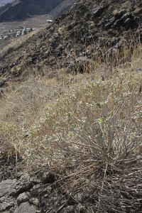
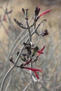
Red blooming thing maybe chuparosa

The holiday break begins with a quick trip to visit an old friend who’s vacationing in Palm Springs. I seem to bring warm weather with me: the days are in the upper 70s and the air is desert-dry. The local weather report whines about only “partially sunny” conditions, though the only clouds I see are thin white veils high in the atmosphere. Good hiking weather, I think. My friend is just a little equivocal but he finally caves. “OK, but nothing too strenuous.”

The North Lykken Trail is picked for its easy proximity to where we’re staying and its promise of nice aerial views of the Palm Springs and the rest of the Coachella Valley. The online writeup calls it “moderately strenuous,” as does Philip Ferranti’s 140 Great Hikes in and Near Palm Springs. It seems doable and fun, so off we go.

Blooming chuparosa (Justicia californica, this first image) is everywhere. And where there’s chuparosa, there are hummingbirds and buzzing clouds of bees feeding on its nectar.

Encelia farinosa leafing out in December

Plants of brittlebush (Encelia farinosa) are everywhere too, but most are just leafing out from their long dry summertime coma. Soon they’ll be covered in bright yellow daisies. This plant usually calls dryer areas home but can be found all the way to the coast, and it’s used a lot in landscaping projects.

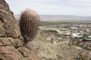
Cactus with a View

Here’s a barrel cactus (Ferocactus cylindraceus) with an awesome view of the city.

Maybe we’re distracted by the view or I’m too focused on the plantlife, but by about now we’re scrambling over piles of rocks, in and out of drainages, looking for the trail. If we were deep somewhere in the wilds without a map we might be getting concerned. But how can you say you’re lost when there’s a big city grid down below as a reference point? Okay, we’re not really lost, but some of this is on the strenuous side of “moderately strenous.” But not for too much longer. We find some other hikers off in the distance and get back on the trail.

Rock Formations Over Palm Springs

With the trail securely underfoot it’s easier to take in the great rock formations and enjoy more of the views.

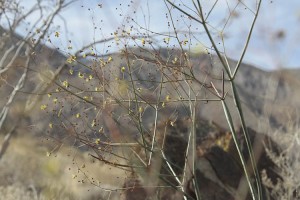
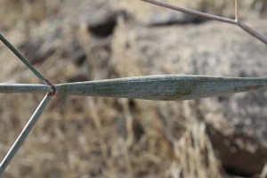
Eriogonum inflatumEriogonum inflatum stem detail

It’s a bit away from peak bloom but there are a few other things to see. This is one of the desert plants I’ve always found pretty interesting, whether it’s in bloom or not. Desert trumpet or pipeweed (Eriogonum inflatum) is an unmistakable buckwheat that usually has flowering stems with a fat trumpeting protuberance below the nodes of its bloom spikes. Often it’s a lot more pronounced than in these two photos.

Sometimes, though, you find a plant that produces stems that are wiry and delicate, with none of the bulging that you see here. Some botanist had some fun naming that one: Eriogonum inflatum var. deflatum.

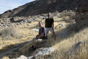
Larry and Me Hiking

Looking at views and plants is hard work, so we take a number of brief breaks, this one in Chino Canyon. (That’s me to the right, the slavedriver ready to move on to the next ridge.)

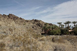
Edge of habitation from the ground

This is a hike that makes you hyper-aware of the edges where the desert ends and irrigated human habitation begins. Even though the plants used in this home’s landscaping may say “desert” to you, you can see that the real desert here isn’t one that stays palm-tree-green year-round.

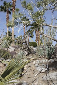
Irrigated succulent garden

Even a collection of dryland plants can require water to keep looking good when they’re planted closer together than you’d find them in nature. Also, some of these plants–particularly the palms–would be only found in more riparian desert habitats, not here where the homeowner wanted them. Check out the drip-irrigation octopus in the lower right corner.

But I suppose it’s hard to resist the temptation to landscape with the plant that’s in your city’s name. Now we’ll just have to work on the “springs” part to make sure all the palms have enough water to survive this challenging piece of desert.

So by now you’ve probably guessed that at least one of us survives the hike. We both do, actually, but are a little sore the next morning. That’s where the artificial springs–the burbling hot tub, in this case, in the semi-shade of the palm trees–comes in handy.

And then my liberal guilt kicks in. As a tourist am I perpetuating a double standard, expecting water and shade be provided me, when I might expect the people living here to make do with less? Okay, if I had to choose, I really could do without the hot tub. But the hike was great.

destination: yellowstone

At the risk of sounding too much like Christian on Project Runway, I’m about to embark on a little “vay-cay.” I leave San Diego on Wednesday in my old Jeep Cherokee for what could be its last major trip to the American West.

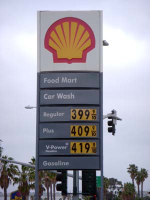
gas prices on April 30These days I worry about gas prices, my carbon footprint, and the mechanical reliability of my trusty vehicular companion that I’ve had since it was a baby, back in 1993. My preferred modes of transport the last seven years has been scooters I’ve owned, the first a zippy little Aprilia Scarabeo 150, and now a big Buick of a scooter, a 582cc Honda Silver Wing that weighs over 500 pounds. It has no style, but I got it for cheap. (For all its massiveness, it still gets almost 50 miles to the gallon.)
Above: the Shell station down the hill on April 30, before they raised their prices.

But the thought of strapping two camera bags with three cameras, two serious tripos and a big steel box of film to the scooter sounds a little crazy. And that’s before you factor in the camping gear and multiple changes of clothes to keep me looking semi-snazzy. Important things, you know. Besides, when I floated the idea with John–mostly in jest–his jaw dropped with concern.

“Yellowstone? On a scooter?”

Maybe I was cruel to even scare him like that, particularly after the episode six years ago when he spent seven weeks taking care of me when I was piled into a wheelchair after a little meeting of the body with hard pavement. But the Jeep it will be for this trip. And not only will the trip be in a car, I’ll at John’s urging be packing a cell phone, in case the Jeep breaks down.

That cell is a big move. Even though I’ve been doing email for over twenty years and have had my own web site for well over ten, I’ve been a total Luddite when it comes to cell phones. Yes, they’d be handy to have sometimes, but I’m not willing to chance being turned into one of those people–You know the type: device planted firmly to ear, muttering inanely about foot cream or last night’s pasta salad to whoever will listen, and often doing it in a moving vehicle while driving distractedly like a chauffeur on a Quaalude jag. Pray for my soul, folks.

So, cellphone in pocket, I’ll be heading north through Las Vegas into the Nevada outback, through desert towns with great names like Elgin, Carp(?!), Ely, Pioche, Jackpot and Caliente. (In naming just six cities, I’ve named virtually all the cities on the map on this route that cuts due north through the Great Basin, along the Eastern edge of Nevada.) The nominal destination is Yellowstone, and I intend to get there. But who knows what else I’ll find. There might even be some cellphone reception along the way!

the mojave phonebooth: part 1, weird at first sight

I first ran across what later came to be known as the Mojave Phone Booth in January of 1993 or 4. I’d been camping that weekend in what was soon to become Mojave National Preserve, and one day was exploring some of the features on the north end of the park-to-be. There the park butts up against I-15 and the thriving tourist waystation of Baker, California, touted on signs throughout town as “Gateway to Death Valley.” Baker is home to what’s claimed as the “world’s largest thermometer,” 134 feet tall–a foot for every degree that made up the hottest temperature ever recorded at Badwater in Death Valley. Baker is also known for the Mad Greek Restaurant, a busy and basically okay eatery that serves up Greek -Mexican-American cuisine in portions that you might expect in a town that owes its success if not existence to travelers heading for that shining shrine of excess, Las Vegas, which at one point in my life was my all-time least favorite swath of soulless human desolation on earth. But enough Vegas-bashing and back to the Preserve…

The most dramatic features on the land are a chain of multicolored volcanic cinder cones. I think of them as single-use volcanoes: Unlike their big brothers that build to some size over long eras, cinder cones mark a short period of eruptions that builds them to a few hundred feet high. And then the eruptions stop, the route to the magma below closes up, and when the ground’s finally ready to erupt again, a new crack opens up, away from the first cinder cone, creating another, separate cone.

Here at the Mojave Preserve there are piles of them–some of them pristine in their perfect pyramidal geometry, others reshaped by mining operations–and they guard the western edge of Cima Dome. Just a few miles south of the world’s largest thermometer, Cima Dome hosts the world’s densest population of joshua trees, and that’s what you notice first. But the feature is called a dome and not a forest, and as remarkable as the j-trees are, growing denser and green as you get farther out on the dome, it’s the geology and not biology that makes this place so amazing.

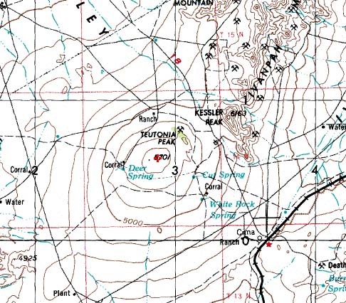
On a topo map you can easily make out the uniform concentric rings of the dome as it rises over 1500 feet from the lower points around it. In real life it’s a lot more subtle. You look at the ground as it rises, gradually, perfectly, and you get a torqued sensation that something is happening, but you’re not quite sure what. You stare and it looks like you see the curvature of the earth, though instead of flying high over it, you’re standing right on it. Space seems to distort as what you expect to be flat bulges up. Queasiness sets in. Welcome to Cima Dome.

Cima Dome topo


The place has this amazing power and force that the touted 1960s and 1970s earthworks can’t begin to approach. In terms of spatial power, as interesting as they are, Robert Smithson’s Spiral Jetty, Michael Heizer’s various constructions, and James Turrell’s Roden Crater can’t hold a candle to it. Sorry guys!

So there I was, jeeping through the j-trees and the spatial queasiness, when I encounter a fence, a cattle guard, a power line and a powerline road crossing the jeep track. And next to the road, next to one of the power poles is a phone booth. A phone booth? A dozen miles from anything? A freaking phone booth? But out in the desert you see a lot of…unusual…things. And I stuck the phone booth as another entry in my brain’s cataloging of desert sights and sightings. Little did I know what I’d just seen.

[ go to part 2, i told you it was weird ]

when landscaping fails

Desert Center, California lies about halfway between Indio and the Colorado River, halfway between a hot, flat desert town and the Arizona border. Unless you need to stop for gas, you pass by it on I-10 at wide-open highway speeds. It’d be a blur like any other anonymous desert town if it weren’t for the palm trees.

The huge date palms there grow single-file in formations that describe wide circles, V-shapes, or a triangle that’s many acres across. Transplanted there by Stanley Ragsdale in the early 1990s, most of the trees now have seen better days. Even for drought-tolerant date palms, irrigation is essential here in the low desert. The watering proved inadequate and many of them died. In their current state of falling into ruins the trees are visually amazing, the vegetable equivalent of the Acropolis.

Palms 1, Desert Center

James SOE NYUN: Palms I, Desert Center, California

I first went to photograph the town and its trees in 2003 on a hot, breezy day in April. It was approaching noon, and there was no shade other than what a minimal palm trunk could provide. It’s not the sort of lighting situation that a lot of photographers consider acceptable, but for this body of work it was perfect. Besides, so many of the well-known 19th century expeditionary photographs of the American West were taken in harsh conditions similar to what I encountered. Palms I, above, and Palms II, below form a diptych: Imagine Palms I on the left and Palms II on the right.


James SOE NYUN: Palms II, Desert Center, California

There weren’t many structures there next to the interstate, not much beyond the obligatory cafe and gas station. The big surprise, though, was an abandoned school, compact, constructed of brick, and modern in its architecture. It had almost no windows in the classrooms except for high clerestories place beneath broad, sheltering eaves. Not that different from the schools I attended up in the Los Angeles area, I thought. In photography–and in painting for centuries before it–ruins are often a bit of a cliche, but name me a landscape photographer who hasn’t shot some at some point. I couldn’t resist:

Desert Center School

James SOE NYUN: Breezeway, Abandoned School, Desert Center, California

Both the palm trees and the town clearly had seen better days. Stephen A. Ragsdale, the man who founded the town in 1921, died in 1971. Stanley Ragsdale, the one who directed the planting of the trees, died in 1999. Without their energies, this area of the city faltered, and the palms began to fail. The town and these landscapes shot there function for me like Northern European vanitas paintings, reminders of life’s struggles, its shortness, and the certainty of entropy. Again, those aren’t transcendentally fresh ideas, but to see them particularized in a place that’s struggling though still very much alive fascinates me. Judging by the number of people who leave the highway, gas up, then drive slowly towards the palm formations, I’m not the only one who’s fascinated.

For more information on Desert Center see: Wikipedia / The Center for Land Use Interpretation.

For more information on the large series this images are a part of see: James SOE NYUN: Blue Daylight Project.