All posts by James

an artist in the garden: Manny Farber

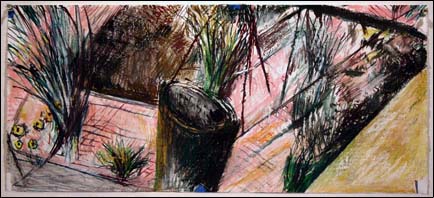
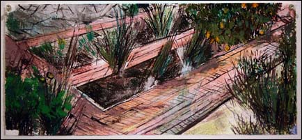
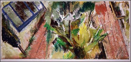
Manny Farber, one of San Diego’s treasured local artists, had a new exhibition at Quint Contemporary Art in La Jolla (actually just a neighborhood of San Diego, but don’t tell that to the La Jollans). The title of the show is “Drawing Across Time,” and features works on paper Farber executed in the garden of the home that he shares with fellow artist Patricia Patterson.

Manny Farber Drawing Across Time image


Manny Farber Drawing Across Time image


Manny Farber Drawing Across Time image
Manny Farber. Drawing Across Time (details). Mixed media on paper, 9 7/8 x 22 3/8 inches.

Lively diagonals animate the horizontal-panoramic-format mixed-media works, and space swirls around with the garden viewed simultaneously from different vantage points. His earlier work, such as the one below, share a similar sense of space, but being closer to drawing than painting, the work is freer, looser and more immediate. And of course be sure to add two and a half decades of thoughtful development to the equation.

Manny Farber: Sam's Bunch 1980-81
Manny Farber. Sam’s Bunch, 1980-81. Oil on canvas, 43.7 x 52.2 in.

Unfortunately, the exhibition closed yesterday, on June 14, but the Quint Gallery site has a generous sampling of the work online.

long shelf life for seeds

When I’d heard years ago that a lotus seed from China had germinated after laying low for 1300 years I was pretty amazed. That was from seed collected in 1982 when Shen and Miller at UCLA sprouted a number of seeds that were radiocarbon dated to be anywhere from 95 to 1288 years old, plus or minus a few years.

But when I heard the news making the rounds now that a two-millennium-old date palm seed from Masada had sprouted, I was definitely impressed.

Studies of the lotus plants grown from the old seeds showed that all were abnormal, a fact that the scientists attributed to radiation-induced mutations that occurred as a result of naturally-occurring radiation in the soil where they were found. The date palm–which has been dubbed the “Methusalah tree”– however, has been growing spunkily since it was sprouted in 2005, and is now five feet tall. If that palm doesn’t take the cake in the more-heirloom-than-thou plant contest, I don’t know what would!

space alien in san diego?

The evidence!

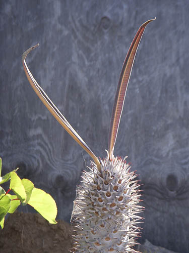
head of pachypodium

Okay, okay, I’ll admit it. Despite a certain resemblance to the classic “Martian popping thing” available at Archie McPhee’s, it’s actually the final two leaves on a Pachypodium geayi, a succulent and spiny first-cousin to the better known plumeria that is such a fragrant staple in Hawaiian leis.martian popping thing

entire pachypodium plantKept moist, and during the cooler and wetter parts of the year, the plant is a spiny column ringed with a rosette of long gray-green leaves. Drop the watering, and the plant goes into defensive mode, dropping its leaves and making like a cactus. Where we have it, in the back of the back yard, it gets to dry out along with the rest of the drought-tolerant plants, so we get to see its “cactus” behavior most of the summer and into fall. When the water starts up, the leaves come back and it’s happy again.

This species can produce pendant cream-colored flowers with reflexed petals. They’re not the most spectacular bloomers in the Pachypodium genus–P. lamerei could be confused for a plumeria if it weren’t for the spines on the plant.

This plant is about ten years in the ground and is coming up on four feet tall. Mature plants will get triple or quadruple the height of this teenager. More water would help it along, I’m sure, but in my yard it gets what it gets.

So far no pests have bothered it. Would you?

attack of the killer tomatoes

I mentioned coming back from vacation and almost immediately going after one of the tomato plants that had taken over its spot in the new ornamental bed.

My killer tomatoes

Just one week later and it seems like I’m continuing to relive scenes from that 1970s schlockbuster, Attack of the Killer Tomatoes. (It was a movie so awful you had to love it, and it had the added bonus of being filmed right here, in San Diego, much of it in Mission Valley, not more than 3-4 miles from my house. Imagine a horror flick where the evil elements are little tomatoes that jump up and go after the jugular of the person preparing to put them in his salad. Lots of tomato juice was spilled in that flick but all in the name of a ridiculous plot line. Unfortunately, all that seems a little sickly prescient these days when people are being advised against eating tomatoes for fear of salmonella poisoning…)

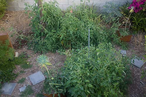
My tomato problem began with two plants from the garden center, the heirloom Mr. Stripey, show in the back of the photo, and the ubiquitous modern hybrid Early Girl, which is shown in the front, a week after I’d already chopped a third of the plant. Both are indeterminate vines, which means they keep growing and growing throughout their short life spans. The good consequence of that is that they continue to bear fruit for months. The bad is that they can grow out of control–I measured Mr. Stripey and he’s already eight feet across and four high, and this at the start of only June! There are tomato cages in that picture, but can you seem them?

One lesson learned out of all this is that tomatoes can respond to too much water by growing like crazy, while not necessarily producing any more fruit. These two monsters were planted in the “guilty pleasure” flower bed, where some higher water-use tropical necessitate watering more frequently than I would in a vegetable garden. You can restrict size of the plants somewhat by reducing the watering–or by pruning shears.

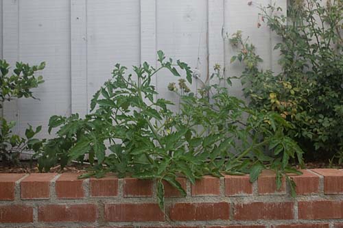
A couple months ago I’d written about saving seeds from Cherokee Purple, that ugliest and most tasty of tomato varieties. Those transplants so far are a lot better behaved. The one below is only about fourteen inches tall and two feet across, and it’s been blooming for three weeks–But then again small and well behaved is how the killer pair in the ornamental bed started. At least Cherokee Purple has a reputation for balancing plant size with productivity and high fruit quality.

Cherokee Purple tomato plant

If the plants don’t overrun the garden this should be a banner tomato year, and I’m already getting ready to whip up salsa, caprese salads and plates of fresh tomatoes dressed lightly with basil and olive oil and a little salt. In the meantime I’ll be standing guard with the shears.

more about golf: virtual and in pictures

In South Korea 200,000 golfers a day are discovering that they don’t need golf courses to play the game anymore. The New York Times site ran a video piece on how virtual-reality golf is taking the golf world by storm. Take a look:

Virtual golf image

It’s golf–more or less–but with no unnecessary water use, herbicides or pesticides!

Artist Skeet McAuley did an artist’s residency with the Museum of Contemporary Art, San Diego in 2000. During that time he did a photographic series on golf courses in this area. Conceptually one of the things he was interested in was the total fake-ness of courses in relation to nature. In fact the title of the exhibition that came out of the residency was “The Garden of Golf.”

Skeet McCauley golf image

Skeet McAuley. The Meadows Del Mar Golf Course 4th Fairway, San Diego, California, 2000, Fujichrome print, 32 X 88 in. [ source ]


The resulting works were large, conventionally beautiful landscapes shot on golf courses. “Nature” has been rendered green and friendly, pretty and harmless. The images point out the way golf courses insidiously homogenize the natural world into a pre-ordered set of expectations of what nature should look like. In this world, there’s no room for snakes or tigers, weeds or brown patches of earth.

In this fiction of nature, going to a golf course becomes a virtual experience of the real world. It’s merely an approximation. At some level you may think you’re interacting with nature, but it ends up being as faked an experience as the Korean golfers and their golf simulation facilities.

yellowstone "wild" flowers

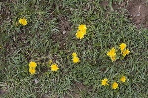
There were a number of spring flowers doing their thing at Yellowstone a couple weeks ago. I saw a patch of bright yellow and took this photo:
escaped dandelions

Yes, dandelions. They were all over. I talked to a ranger nearby who said that the park has a big problem with invasive species. He wasn’t a botanical expert, he said, but he thought there was a true wild dandelion, as well as the garden version. Unfortunately, this to me looks like the garden version. They were all over the park, as well as all over Idaho on the way there.

teed off

In wildness is the preservation of the world.
Thoreau

In a desert, golf is the utter ruin of the known universe.
Me

This is the week of the U.S. Open golf tournament here in San Diego. Something like 42,500 spectator tickets per day have been sold for three days of practice rounds and four of competition. It’s being described as having a string of Super Bowls hitting town, seven days in a row.

To mitigate the potentials for traffic headaches they’re running shuttles for the spectators from Qualcomm Stadium, where they last played the city’s last real Super Bowl, up to the Torrey Pines golf facility, located on the brink of a cliff four hundred feet above the broad sands of Black’s Beach, one of the most spectacular clothing-optional beaches remaining anywhere. And yes, in addition to being a spectacular location for a nude beach it’s also a stunning place to plant a golf course.

Torrey Pines golf course

The Torrey Pines golf course [ source ]

In addition to the shuttles, they’re asking employers surrounding the golf course to limit how many employees show up at work this week. Beyond that, some of the office buildings that border the golf course effectively have been ordered shut down. Rumor is that they don’t want non-paying working stiffs to get a free look at Tiger or Phil or Adam, and that there are security concerns.

To add to the chaos, add to everything that this is finals week at the University of California, located just across the street from the golf course. Oops.

All that rubs me the wrong way. While it might be appropriate to maintain golf courses in cool, wet places like Scotland, it seems somewhere between bizarre and socially irresponsible to dedicate thousands of acres to the game of golf in the desert that is Southern California.

Water is at the forefront of many a Californian’s thinking. Many of us plant our gardens with drought-tolerant plants to maximize our water usage, and we try to limit the size of our lawns.

The San Diego County desert town of Borrego Springs grew to some size as an agricultural area, then began to attract people who grew the town even further. With those people came golf courses and the kind of water use that goes with them. The numbers aren’t exact, but of the total water intake of the town, something like ten percent goes to households (including landscaping), while twenty percent goes to golf courses. The rest goes to the farmers who are complaining that their aquifer is being drained dry. The proportion of water use between residences and golf courses is similar in other desert areas like Palm Springs. So, in a desert, huge numbers of golf courses don’t make much sense.

In addition to the water issues, golf courses are profligate users of pesticides and herbicides. After all, who wants to play golf on a course with brown spots? The Beyond Pesticides site posted a piece establishing links between golf course chemical use and various cancers, and Golf Digest of all publications ran an article, “How Green is Golf,” in its recent May 2008 issue looking at the issue.

Their conclusion? “New courses in the desert will become rarer,” and “The residue of synthetic chemicals are found in high concentrations as far away as the Arctic,” and this quote from a participant at a symposium at Pebble Beach: “From what I know about Augusta National, it’s really a television studio and not a golf course.”

There are signs of encouragement. The weekend San Diego Union-Tribune had an article on how master-planned golf communities are on the wane here in town. Much of the reasoning is economic. There were days when you could build a course here for a million dollars a hole, but rising land values have made that impossible. Seems that the majority of the people who bought into a golf community valued the perceived open space, but only a minority of them ever played the game. It’s proven to be cheaper to set down some hiking trails and preserve the natural open space. In addition, with what is known now about the health hazards of living on a golf course, who’d want to pay extra for the privilege?

So this week I get to endure the U.S. Open along with much of San Diego. While I’m doing that, I keep flashing to this picture in my mind of a driving range that I saw on the outskirts of Borrego Springs, probably the most socially responsible golf facility that I’ve seen anywhere. (Next time I’m out there I’ll try to snap a photo of it.) What tells you it’s a driving range isn’t the sickly fake-green color of its grass. In fact, nobody waters it, and the range is the color of the surrounding desert.

Instead, what tips its hand as a driving range are the golf balls scattered over the facility: thousands of the little white things, glistening in the vibrating mirage-inducing midday atmosphere like bright desert rocks arrayed over the pale brown sands. Now that’s my vision of paradise!

on the road–part 2

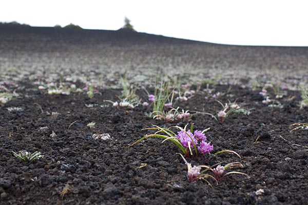
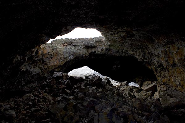
Late on the night of Day 2 I roll into Idaho’s Craters of the Moon National Monument. Like Yellowstone it showcases some striking volcanic feature, in this case recent eruptions along the local rift zone in the Earth’s crust. Here are a couple shots from Day 3, images of an intense wildflower bloom and of residual ice in Indian Tunnel, a lava tube you can explore.
Blooms at Valley of the Moon N.M.

Snow in Indian Tunnel, Valley of the Moon N.M.

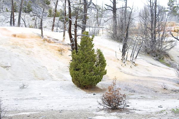
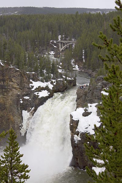
Then it was on to Yellowstone. Here are some of the pics from there, in no real order.

Upper Falls of the Yellowstone River:Upper Fall, Yellowstone River

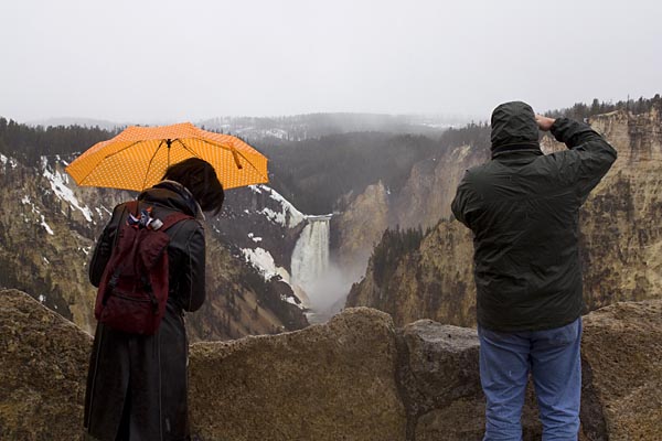
Tourists at Artist’s Point overlooking the Lower Falls of the Yellowstone River. The artist in question is Thomas Moran, who used this vantage point for his famous image of the Grand Canyon of the Yellowstone River.
Tourists at the Lower Falls of the Yellowston River

Tourists at the Lower Falls, Yellowstone River

Spring thaw beginning on Yellowstone Lake:
Spring thaw, Yellowstone Lake

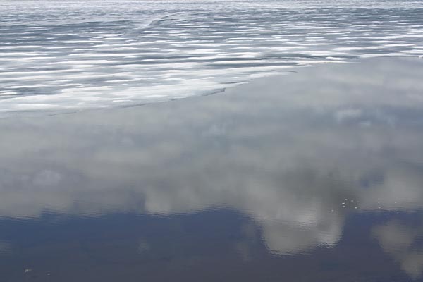
Clouds and ice, Yellowstone Lake:
Clouds and ice, Yellowstone Lake

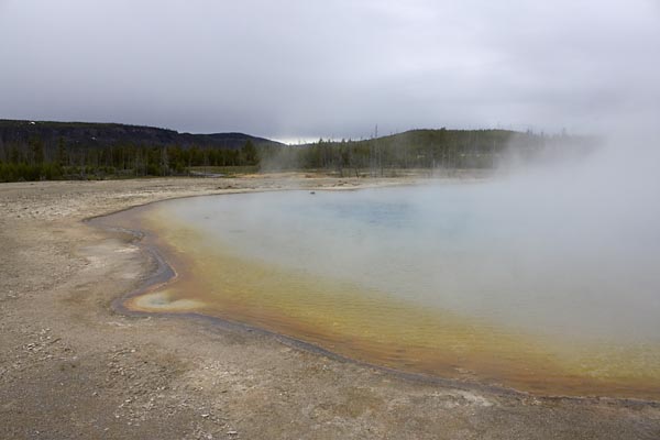
Sunset Lake, Black Sand Basin, Yellowstone:
Sunset Lake, Black Sand Basin

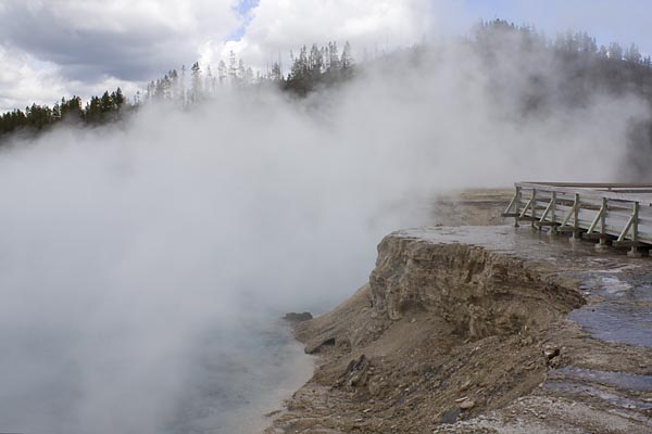
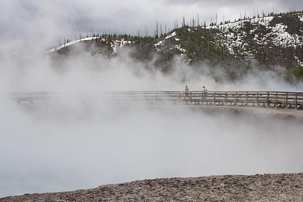
A couple shots from Midway Geyser Basin, from the brink or Excelsior Geyser:Midway Geyer Basin, Yellowstone

Midway Geyser Basin

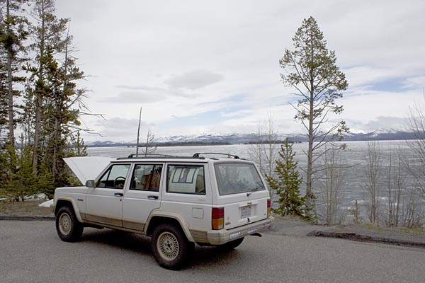
The Jeep didn’t care for the cold, wet weather, and took its own vacation by the side of Yellowstone Lake.
Broken down next to Lake Yellowstone

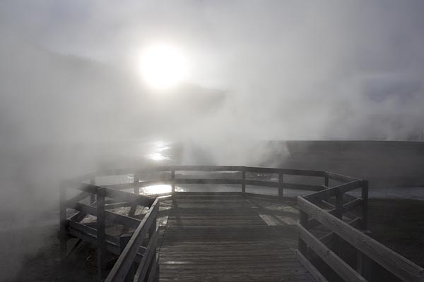
Viewpoint at Ledge Geyser, Black Sand Basin, Yellowstone, with some of the only sunshine all trip:
Ledge Geyser overlook, Black Sand Basin, Yellowstone

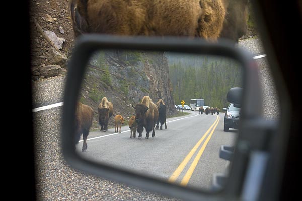
The worst of the trip’s bison jams, this one when a herd of about five dozen was moving from their breakfast to lunch grazing locations:
Bison jam, Yellowstone

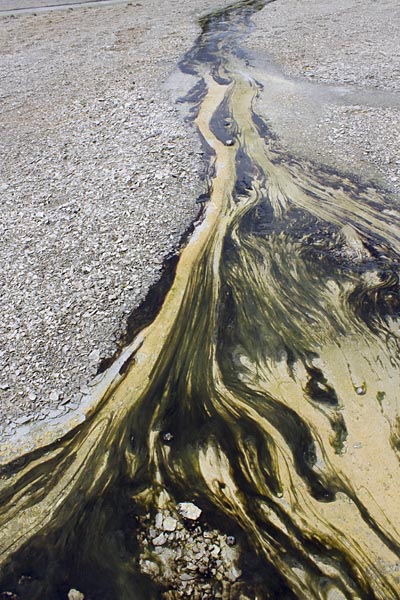
Algae in the geyser runoff at Norris Geyser Basin:
Algae at Norris Geyser Basin, Yellowstone

What? No pictures of Old Faithful? Sorry. There’s a couple hundred more of these tourist pictures but I’ll spare you. Once I start printing up some of my more “serious” photographic work and have something to show I’ll post a few more images.

on the road–part 1

I guess it’s comforting that the blog doesn’t have a mind of its own and just write itself while I’m away on vacation…

Well, I’m back from points north, including 8 days in Yellowstone. Here’s a quick look at the trip now that I’ve had a chance to organize some of my tourist pictures.

Day 1, less than an hour out of Vegas, and I’m off pavement already. I could have sworn the map showed this stretch of the road going through the Mormon Mountains as being paved, so encountering dirt so soon is a bit of a surprise.
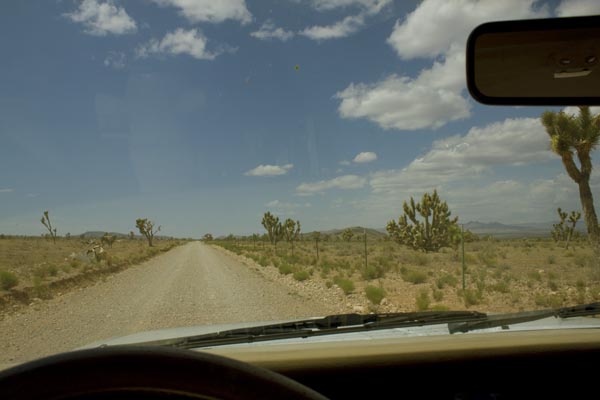
An hour out of Vegas

But as you can see it’s a good dirt road, as friendly towards Buicks and Honda sedans as it is towards my Jeep, and it connects up with an equally good gravel road as shown on the map. After a few dozen miles, the gravel road hooks up with pavement, as promised. But wait: Road Closed?

road closed

The blacktop looks fresh and smooth and the stripes shiny and new, so how closed can the road be? Besides there’s no way back other than the way I came, and the gas is getting low.


Well, yeah, half a dozen times the road disappears into the dry little river—generally not a good thing for a road to do—but fortunately they’ve built gravel alternate routes around the washouts for the half-dozen locals to use. So no need to backtrack.

One of a bunch of these lazy snakes taking a Club Med riverside siesta on the warm asphalt:Lazy snake
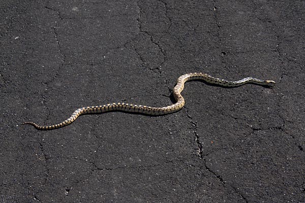
Along the Great Basin Highway

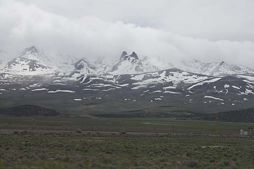
And finally the road hooks up with the Great Basin Highway, the eastern-most north-south route in Nevada. With snow-covered mountains on either side of the highway, it’s incredibly scenic. I’ve always loved California’s Highway 395 along the eastern escarpment of the Sierra Nevada, but I might now have a new favorite drive.

So, after 12 hours of driving from San Diego I’m at the first night’s destination, Great Basin National Park, on the slopes of Wheeler Peak, at 13 thousand and change in altitude the tallest in Nevada. The campground is almost 8,000 feet up, and pretty cold for the middle of May. And what’s this? Snow? Pretty exotic for someone from San Diego.

Day 2 begins with a drive up to the end of the road on Wheeler Peak, to over 10,000 feet elevation, and there the snow picks up. Then back down 3,000 feet to the peak’s caves, Lehmann Caves and year-round 50-degree comfort.
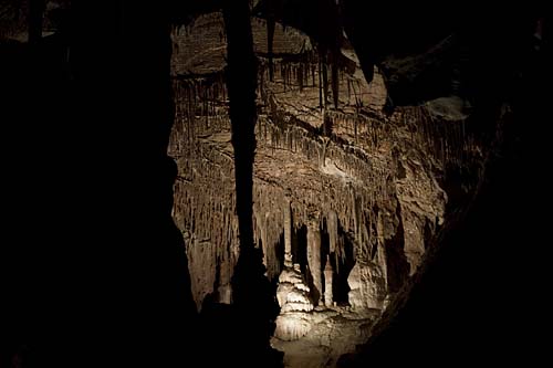
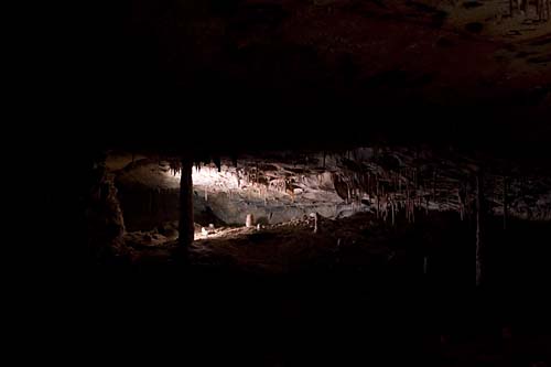
Lehmann Caves

Lehmann Cave

The caves are a medium-sized complex in not-pristine condition. In the early days of the caves, paying your entrance fee entitled you to break off a stalactite or two to take home. And there’s a spot where people used soot from their candles to record their initials on the roof of the cave—tacky and interestingly historical at the same time.
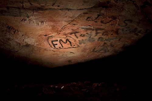
Graffiti in Lehman Caves

More travel on the Great Basin Highway gets me to my first real photographic destination, Shoshone Falls, which was documented by expeditionary photographer Timothy H. O’Sullivan in 1868 and 1874. For something that has been called the “Niagara of the West,” the falls were surprisingly difficult to find. They appear nowhere on the Triple-A Idaho state map, and if it weren’t for there being a street named Falls Boulevard in Twin Falls, I might not have found them. Yes, there was a sign. Partially obscured behind a tree.

O’Sullivan’s images of the falls are clear, forceful, direct depictions of a force of nature. You can feel the awe he felt as he stood on the brink.

Timothy H. O’Sullivan. Shoshone Falls, Snake River, Idaho, View Across the Top of the Falls, 1874. [ source ]


Today, what you find is a major water feature domesticated through hydroelectric impounds, and its banks have houses on one side and a bland suburban looking Frisbee and picnicking park on the other. It was like seeing a wild lion dressed up in a pink tutu and forced to walk on its hind legs. But it’s the sort of destination where the human/nature edges and collisions are dramatic, so out comes my more serious camera gear.
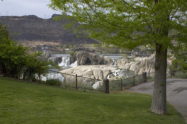

Next: On to Valley of the Moon, and Yellowstone.